Muting the data based on the Topography
![]()
![]()
This module sets a topography line based on the user input. In case the user wants to mute the data with a specific offset range, it will mute the data above the specified offset range. This is calculated based on the Minimum offset mute velocity and Minimum offset values. We've velocity and distance and it generates the time and mutes the data.
If the user takes the bin grid elevation information, then it will mute the data based on the elevation information/datum information available in the trace headers.
![]()
![]()
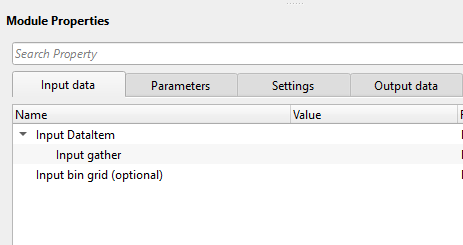
Input DataItem
Input gather - Connect/reference to input gather.
Input bin grid (optional) - In case the user wants to apply the mute by bin grid then it is required otherwise it is optional parameter. Provide the input bin grid.
![]()
![]()
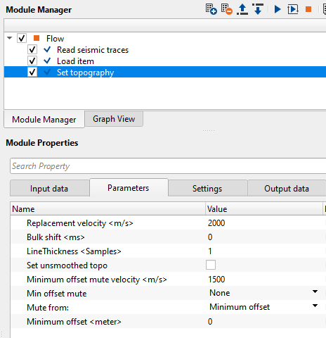
Replacement velocity - Replacement velocity used for elevation correction. The procedure reads elevation and datum values from input trace headers
Bulk shift - By default, 0. Provide constant bulk shift value if required.
LineThickness - By default, 1. This is the line thickness of the topography.
Set unsmoothed topo - By default, FALSE (Unchecked). If this parameter considers unsmoothed topography, in this case, the user MUST provide the input bin grid.
Minimum offset mute velocity - Provide a constant velocity value. Based on this velocity value and the minimum offset value, the mute will be calculated. Distance/space/offset and velocity gives us the time.
Min offset mute { None, Line, Mute } - Choose the one of the option from the drop down menu to decide the muting options.
None - This will not apply any kind of mute irrespective of the Minimum offset value.
Line - This will draw a muting line on the gather (stack) but won't mute the data. This line is calculated based on Minimum offset mute velocity and Minimum offset values.
Mute - If this option is selected, it will mute the data.
Mute from: { Minimum offset, Bingrid } - Choose the option from where to apply the mute.
Minimum offset - This options will mute the data based on the Minimum offset mute velocity value and Minimum offset value.
Bin grid - This will take the elevation values from the bin grid and considers the replacement velocity and accordingly mutes the data.
Minimum offset - offset value that will be considered for designing the mute.
![]()
![]()
Auto-connection - By default, TRUE(Checked).It will automatically connects to the next module. To avoid auto-connect, the user should uncheck this option.
Number of threads - One less than total no of nodes/threads to execute a job in multi-thread mode.
Skip - By default, FALSE(Unchecked). This option helps to bypass the module from the workflow.
![]()
![]()
Output DataItem
Output gather - Outputs the gather.
There is no information available from this module so the user can ignore it.
![]()
![]()
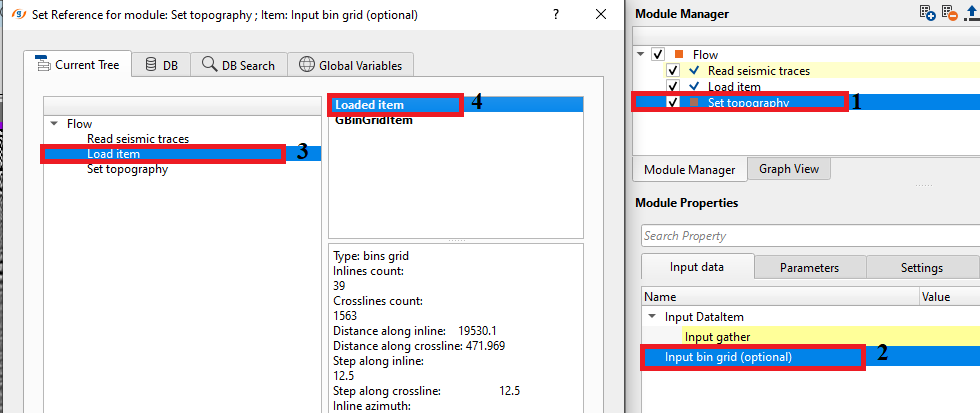
In this example, we are reading a stack section as an input to set topography module. We are reading this stack section by using "Read seismic traces" module with load to RAM option as YES. Also, we are reading the bin grid information by "Load item" module.
We are going to show different Min offset mute options and their output corresponding results. Before that, let's dive into the smoothed topo line, unsmoothed topo line, Min offset line looks like on the stack section.
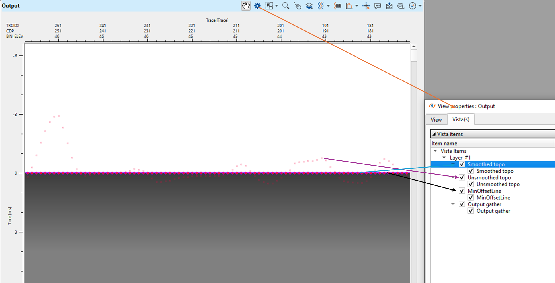
We'll try Min offset mute options None, Line and Mute and the corresponding results are shown below. If we observe, None and Line options didn't change anything except the Line option draws a line as per the Minimum offset & Minimum Offset mute velocity value. However, Mute options muted the data from the Minimum Offset & Minimum offset mute velocity value.
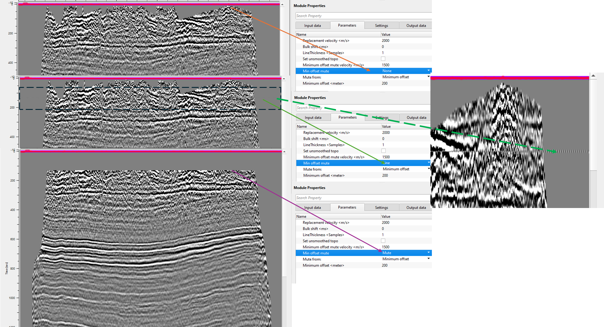
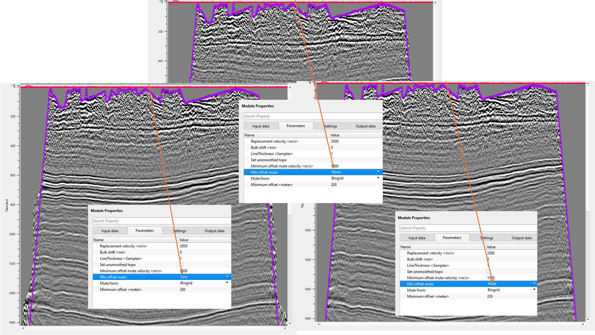
Similarly, let's look into the Bin grid option. Here also, we don't see any changes with respect to None and Line however Mute options mutes the data based on the bin grid.
![]()
![]()
There are no action items available for this module so the user can ignore it.
![]()
![]()
YouTube video lesson, click here to open [VIDEO IN PROCESS...]
![]()
![]()
Yilmaz. O., 1987, Seismic data processing: Society of Exploration Geophysicist
 * * * If you have any questions, please send an e-mail to: support@geomage.com * * *