Read seismic traces
Reading internal seismic files
Theory
Any seismic data within g-Platform using Save seismic, Save seismic by gather modules are saved in an internal format. These internal format files are saved with an extension of .gsd & .gsd.sgy. The former one (.gsd) stores all the trace headers information whereas the later one contains the seismic data. When the user calls for the internal file by using "Read seismic traces" or "Open seismic traces" or any other module, it automatically detects the file location. All the user has to do is, provide the right input file name.
This module is used to read an internal seismic file. It reads both pre and post stack data.
 Caution should be maintained when reading large size(s) of input pre stack data with "Load data to RAM" option as YES. Instead of using "Load data to RAM" to display the data, use "Enable active location map" option. This allows the user to select any source/receiver/bin gather from the location map.
Input data
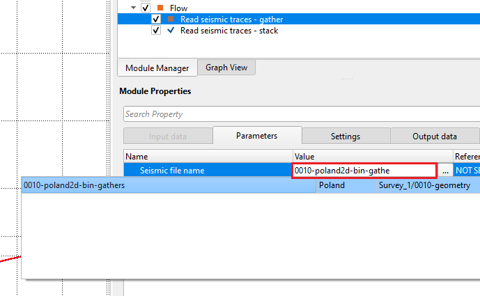
Provide the input data file in the Parameters tab
Parameters
Seismic file name - file name of input seismic file. g-Platform DB (database) knows the location/path of the input seismic file. The user should only need to provide the file name either manually type in or select from the drop down menu. The back color indicates the file is created within the project. If the back ground color is white, it means the file is either created by different project or imported.
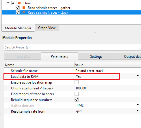
Load data to RAM { Yes, No } - this allows the input data to be displayed as Output. By default, NO. To display the entire input dataset, Load data to RAM as YES. If checked then all the data will be loaded to RAM.
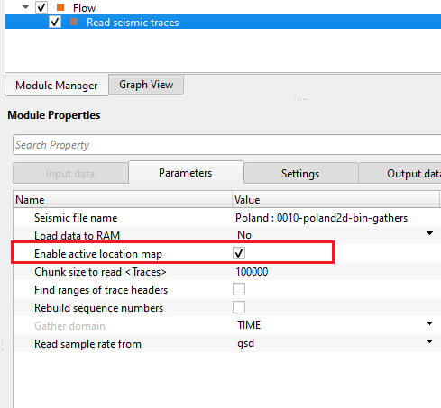
Enable active location map
this allows the user to display the gathers (source/receiver/bin). By default, FALSE. Look for more detailed explanation in the EXAMPLES section.
Chunk size to read - Define the total number of traces should be read at a time as a chunk
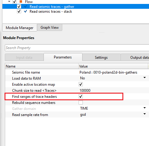
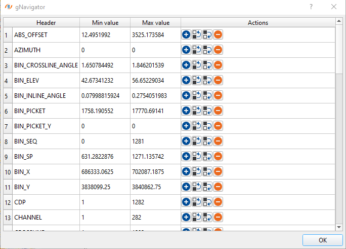
Find ranges of trace headers
If this option is checked, it will find the ranges (minimum, maximum values) of all the trace headers present in the seismic data.
Rebuild sequence numbers
it rebuilds the source, receiver and bin sequences. By default, FALSE.
Gather domain { TIME, DEPTH, FREQUENCY } - allows the user to specify the input data domain type. By default, Time. There are additional domain options available from the drop down menu. Depending on the input data domain type, it will automatically detects.
Time - Input data is in Time domain
Depth - Input data is in Depth domain
Frequency - Input data is in Frequency domain
Read sample rate from { gsd, sgy }
it lets the user to select the sample interval from .gsd or .sgy file.
Settings
Number of threads
One less than total no of nodes/threads to execute a job in multi-thread mode. Limit number of threads on main machine.
Skip
By default, FALSE(Unchecked). This option helps to bypass the module from the workflow.
Output data
Output DataItem
Output SEG-Y data handle
generates the Output SEG-Y data handle which can be used for further connection/references.
Output trace headers
generates output traces headers that can be used as connection/reference to input trace headers.
Output gather
generates output gather which can be used as a connection/reference to other modules. When the user reads a stack
Current source gather
generates the current source gather. This is only applicable, when the user selects the option "Enable active location map". This allows the user to display the current source gather when the user selects the Current source gather from the control item.
Current receiver gather
generates the current receiver gather. This option is also available when Enable active location map is turned ON.
Current bin gather
generates the current bin gather when the user selects the current bin gather from the location map. This option is void if Enable active location map is FALSE (Unchecked).
Information
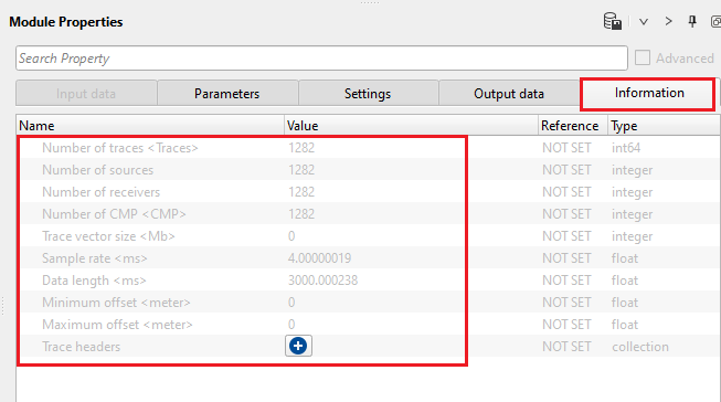
Number of traces
display total number of traces of the input data
Number of sources
displays total number of sources in the input data
Number of receivers
displays total number of receivers
Number of CMP
display total number of common mid/depth point
Trace vector size
displays trace vector size
Sample rate
display the sample rate/interval of the input data
Data length
displays the input record length
Minimum offset
displays minimum offset of the input data. It will be zero in case the input data is stack
Maximum offset
displays the maximum offset of the input data. It will be zero in case the input data is stack
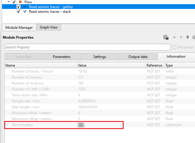
Trace headers
displays the trace headers information in a tabular form. This is only applicable when the user selects "find ranges of trace headers" option in the parameters.
Examples
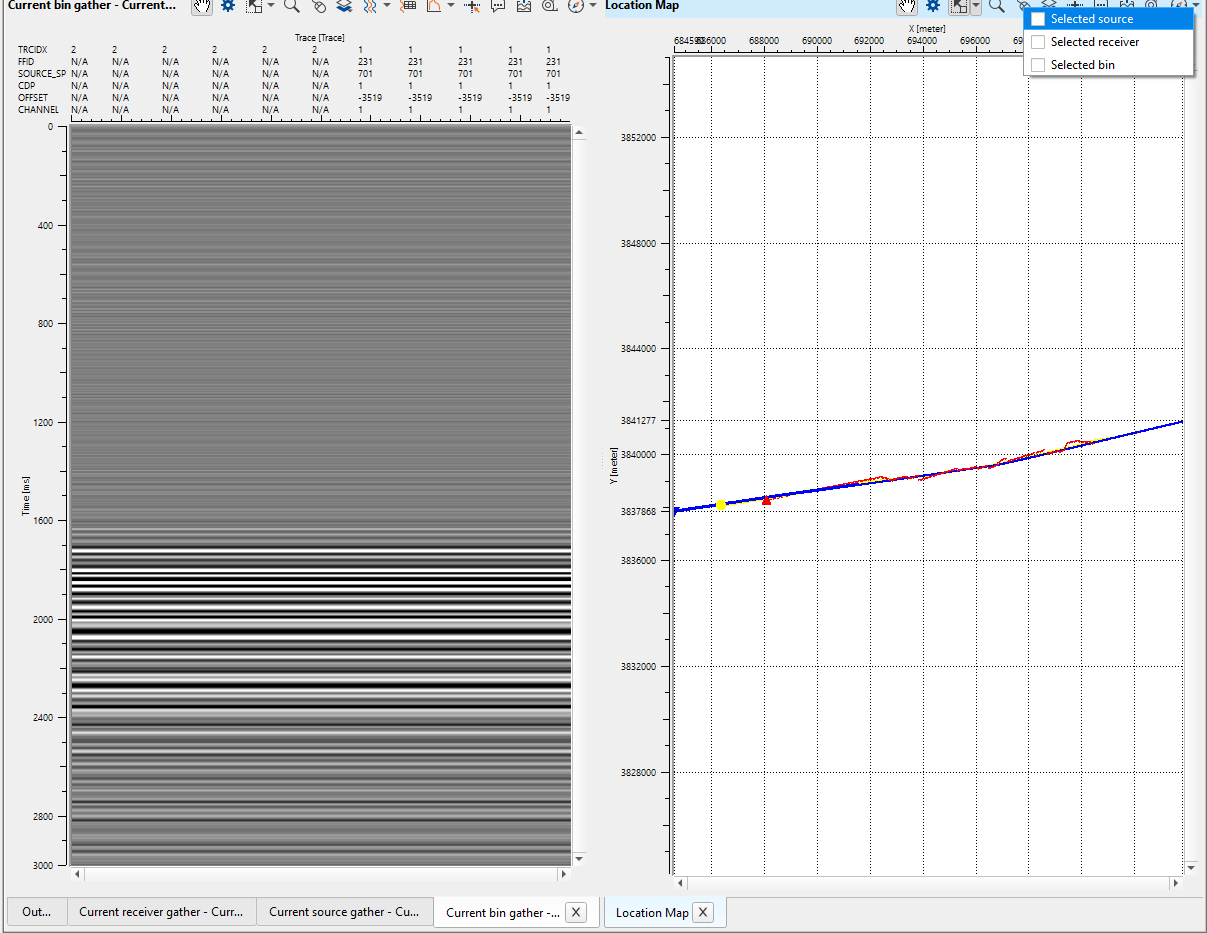
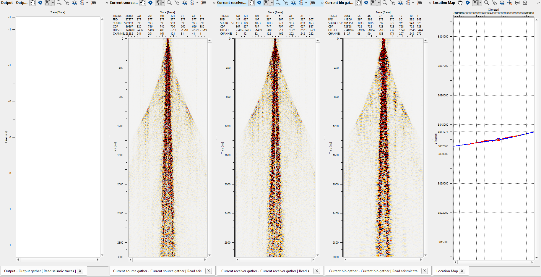
In this example, we are displaying the current source/receiver/bin gather by using the "Enable active location map" option as TRUE inside the "Read seismic traces" module.
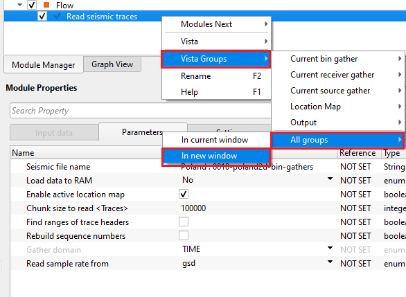
Execute the module and launch Vista items by right click on "Read seismic traces" - > Vista Groups -> All Groups - > In new window.
On the location map, go to  Control item icon and choose "Selected source/receiver/bin".
Choose either one of them or all of them and click randomly on the location map. It will display the current shot/receiver/bin gather of the selected location.
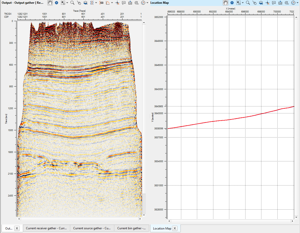
In case of a post stack data (considering small 3D cube or 2D stack sections), turn on Load data to RAM as YES and load the data. In that case, the output will be appeared in the "Output gather" window.
Actions
There are no action items available for this module so the user can ignore it.
Video lesson
YouTube video lesson, click here to open [VIDEO IN PROCESS...]
Related articles
Yilmaz. O., 1987, Seismic data processing: Society of Exploration Geophysicist
 * * * If you have any questions, please send an e-mail to: support@geomage.com * * *