Reading geometry information from ASCII file format
![]()
![]()
Most of the vintage datasets don't have the geometry information in standard SPS formats. Either this information is in a paper section or the user should manually make a record of it in any text editors or excel sheets etc. These files consists of the coordinates information. Often times, elevation information may exist or may not. The user has to manually add this information separately to this file.
This module loads ASCII file that consists of columns with line name, SP, X, Y, elevation and creates views that allow to check geometry visually. It accepts different types of file formats like tab delimited, csv, space separated and manual. If it's tab delimited then it defines the columns automatically and a user just need to choose right columns using combo boxes. In manual mode the user should define location of the columns manually.
![]()
![]()
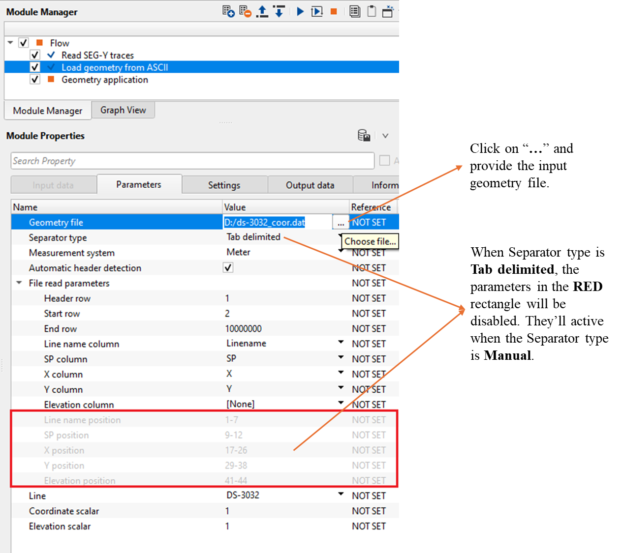
Input file is provided inside the Parameters tab.
![]()
![]()
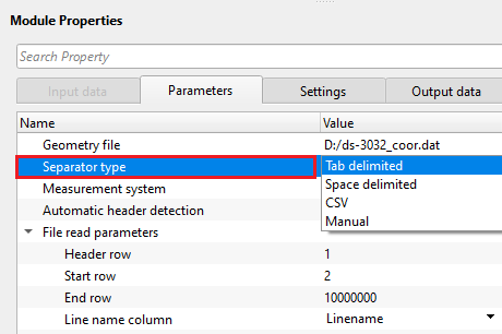
Geometry file - Provide the input geometry file.
Separator type { Tab delimited, Space delimited, CSV, Manual } - Select the input file type from the drop down menu.
The module can work with the following types of format:
1. Tab delimited - columns are delimited by a tab
2. Space delimited - columns are delimited by SPACE
3. CSV - columns are delimited by Comma
4. Manual - columns location can be defined by the user
FileType - Tab delimited - When this option is selected/activated, it will automatically fills the line name, SP, X, Y and Elevation information from the input file provided at the Geometry file parameter.
FileType - Space delimited - Similar to the Tab delimited, this will also automatically detects the input file information and fills the respective fields.
FileType - CSV - This is Comma separated file format, and it will also automatically detects the input file information and corresponding values are assigned against the column names.
FileType - Manual - When this option is chosen, the user has to manually enter the column positions of the individual column values.
Line name position - Enter the starting position to end position of the column of line name
SP position - Provide the Shot Point column position
X position - Provide X-coordinate column starting and ending position
Y position - Provide Y-coordinate column starting and ending position
Elevation position - Provide the elevation information column position.
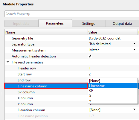
Measurement system { Feet, Meter } - Choose the corresponding measurement system from the drop down menu.
Automatic header detection - If checked, this option will automatically detects the headers information from the input ASCII file for Tab delimited, space delimited and CSV file formats.
File read parameters - This section deals with the input geometry file from where it detects the columns information
Header row - This parameter looks for header row information. Specify from which row the headers information like line name, SP, X and Y coordinates and Elevation information starts from. It is usually 1.
Start row - Starting row of the geometry file
End row - This the last row of the input file. Keep the default value.
Line name column { } - Choose the line name from the drop down menu.
SP column { } - Choose the SP column from the drop down menu.
X column { } - Choose x-coordinate column from the drop down menu.
Y column { } - Choose y-coordinate column from the drop down menu.
Elevation column { } - Choose the elevation column from the drop down menu if elevation information is available. Otherwise, it will be assigned as None.
Line name position - Mention the starting and ending position of the line name column
SP position - Provide the starting and ending column position of the Shot Point
X position - Provide the x coordinates column position
Y position - Provide y coordinates column position
Elevation position - Provide the elevation column position from the input file if elevation information is available. Otherwise, it will be assigned as None.
Line { } - It automatically detects the line name from the input file.
Coordinate scalar - This parameter multiplies the x,y coordinates with the user specified scalar. By default, 1.
Elevation scalar - This is the elevation scalar which is used to multiply the elevations. By default, 1.
![]()
![]()
Skip - By default, FALSE(Unchecked). This option helps to bypass the module from the workflow.
![]()
![]()
Geometry file table - This module generates the geometry file table. It can be exported by using "Export table" module.
Coordinate points - This outputs the coordinate points in a tabular format.
GPointVectorItem -
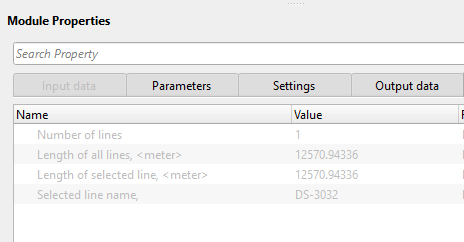
Number of lines - Provides the information about the total number of lines in the input geometry file. In case, it is single line, the total number of lines will be 1.
Length of all lines, - This information provide the length of all lines included in the geometry file.
Length of selected line, - If a single line is selected from the multiple lines from the input geometry file, it will displays the selected line length.
Selected line name, - This displays the selected line name if a single line is in the input geometry file or a selected a specific line from multiple lines in the input geometry file.
![]()
![]()
Here is an example workflow where we are reading a ".dat" extension geometry file which consists of the line name, SP, X, Y information. This file is a tab delimited file.
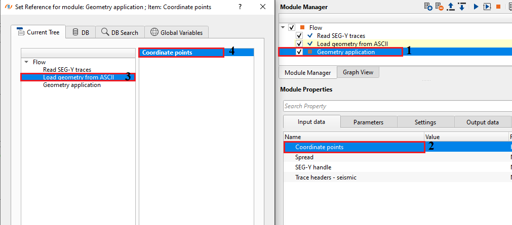
This module outputs the source and receiver collections. This can be reference/connect to "Geometry application" coordinate points.
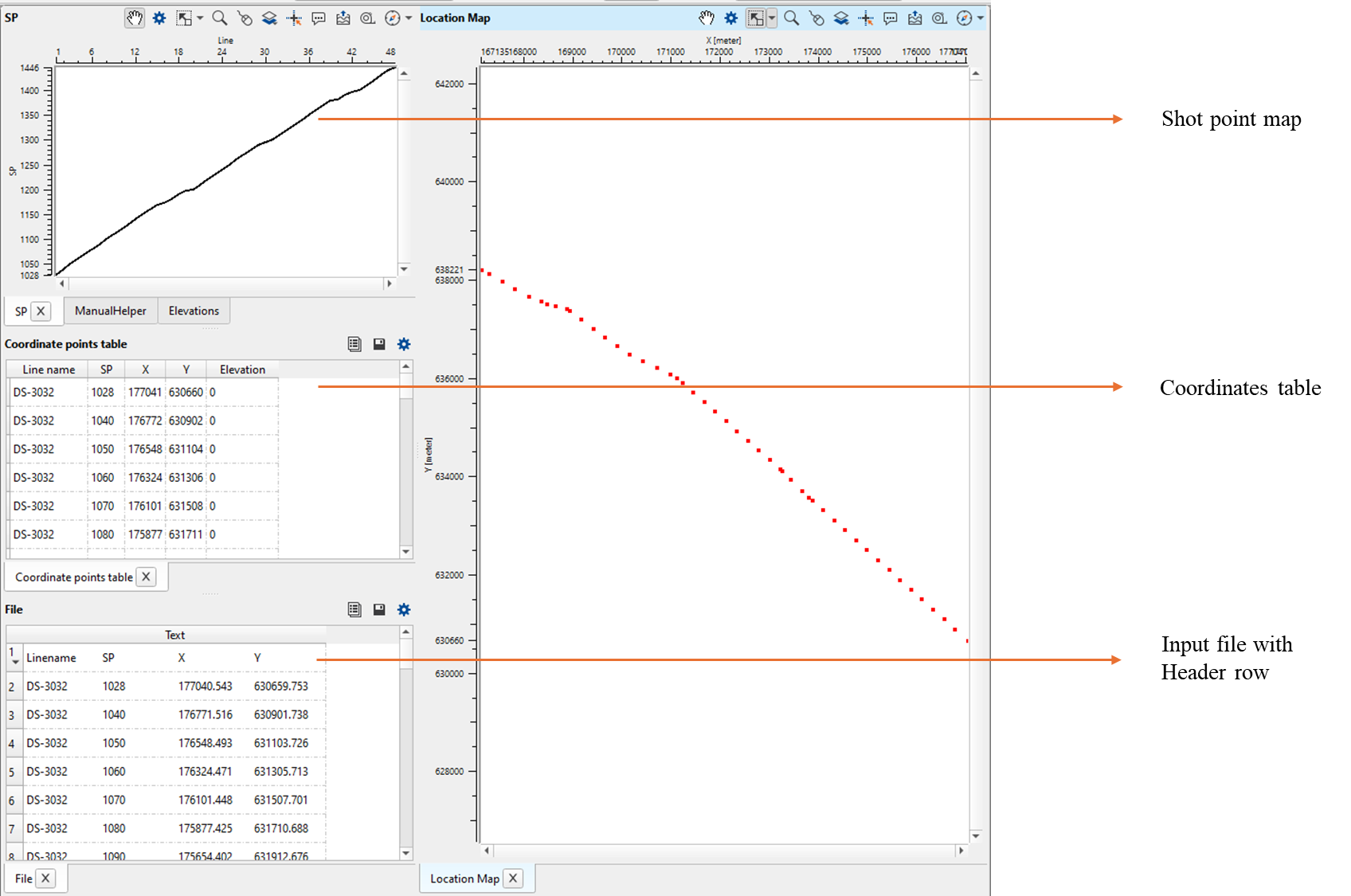
Load geometry from ASCII generates few vista items for QC purpose. It consists of Location map, coordinate points table, Shot Point map, elevation map (if available).
![]()
![]()
There are no action items available for this module so the user can ignore it.
![]()
![]()
YouTube video lesson, click here to open [VIDEO IN PROCESS...]
![]()
![]()
Yilmaz. O., 1987, Seismic data processing: Society of Exploration Geophysicist
 * * * If you have any questions, please send an e-mail to: support@geomage.com * * *