Seismic upscaling in g-Space allows users to integrate seismic data into a 3D grid, converting it into properties that can be used for geological and reservoir modeling.
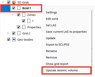
Open the Context Menu
•Navigate to the Data Manager and locate the grid you wish to upscale seismic data for (e.g., "Grid 1").
•Right-click on the selected grid to open the context menu.
•Select the "Upscale Seismic Volume" option.
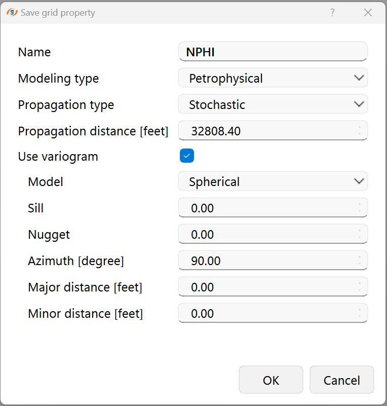
Configure Upscaling Parameters
A pop-up window titled "Upscale Seismic Volume" will appear. Fill in the required fields:
•Name: Enter a name for the seismic property to be created (e.g., "Fractures").
•Seismic Data: Choose the seismic volume from the dropdown list.
•Value Extraction: Select the method to calculate values from seismic data. Options include:
▪Average: Computes the mean value over the selected seismic cells.
▪RMS
▪Minimum/Maximum: Selects the lowest or highest value, respectively, from the seismic data.
▪Median: Computes the middle value, reducing the effect of outliers.
▪Dominant
•Modeling Type: Specify the type of modeling as Petrophysical or Facies, depending on whether the property is scalar or categorical.
•Propagation Type: Choose Deterministic or Stochastic propagation based on how you want to distribute the seismic property across the grid.
•Propagation Distance: Define the maximum distance (in feet or meters) for propagating the seismic property.
Execute Upscaling
•After configuring the parameters, click "OK" to start the seismic upscaling process.
•The system will populate the 3D grid with the seismic property based on the specified settings.
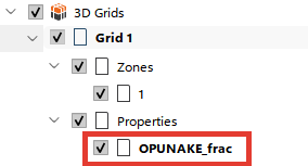
Review and Manage Properties
•Once the process is complete, the new seismic property will be added to the Properties folder under the grid in the Data Manager.
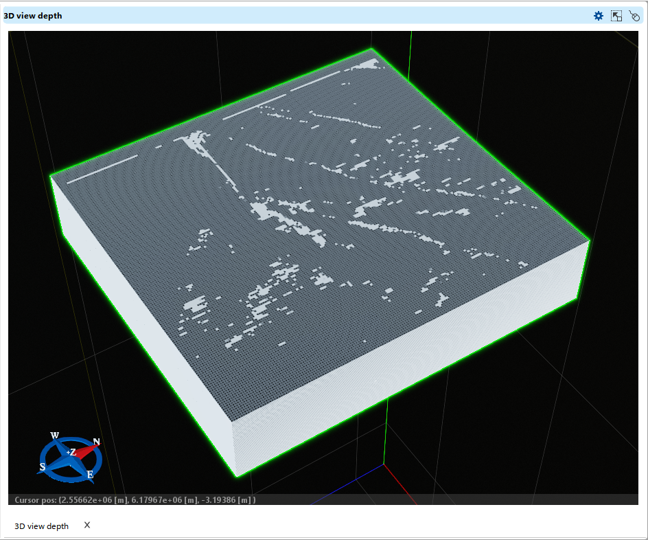
Visualize the Upscaled Property
•Open the 3D Depth View or Section View to analyze the grid with the newly upscaled seismic property.
•Adjust visualization settings in the Visual Settings panel to customize the display.