Seismic Data Formats
SEG-Y is the central seismic format in g-Space: it is used for both import and export, and is reused for velocity models and arbitrary-line export. In addition, g-Space can import several other seismic formats, most of which are converted to SEG-Y on load. SEG-Y files store seismic traces along with essential metadata in trace headers. These headers contain crucial information such as inline and crossline numbers, elevation data, coordinates, and other attributes needed for seismic processing and interpretation.
Import formats
- SEG-Y / SEGY (*.sgy, *.segy) - 2D lines and 3D volumes, post-stack and pre-stack gathers; time and depth domains.
- ZGY (*.zgy) - 3D volumes, 2D lines.
- GSD - Geomage Seismic Data (*.gsd) - 2D lines, 3D volumes.
- SEG-D, SEG-2, SEG-B (SN338 / SN339) - pre-stack field/shot gathers, converted to SEG-Y on import.
- MiniSEED and Seismic Unix (SU) - traces / gathers.
- ASCII to seismic (*.txt) - builds 2D lines / 3D volumes from ASCII X/Y/Z/Value points.
Export formats
- SEG-Y - post-stack volumes and lines, time-to-depth converted, shifted volumes, arbitrary-line sections, velocity models.
- GeoTIFF - 3D post-stack inline/crossline sections as georeferenced raster images.
- CPS-3 line file - seismic line geometry (inline/crossline positions).
Note
Post-stack and pre-stack are auto-detected on SEG-Y import. Pre-stack gather import is license-gated (GEOPHYSICAL_INTERPRETATION).
Notes
SEG-Y files are binary formatted and structured in a way that data is stored in fixed byte locations within trace headers. The trace header is a 240-byte section preceding each seismic trace that holds metadata about that specific trace. Different software applications may use different byte positions for storing similar types of data, leading to variations in SEG-Y file formats. To address this, g-Space provides multiple preinstalled formats and allows users to define custom formats when necessary.
Preinstalled SEG-Y Formats in g-Space
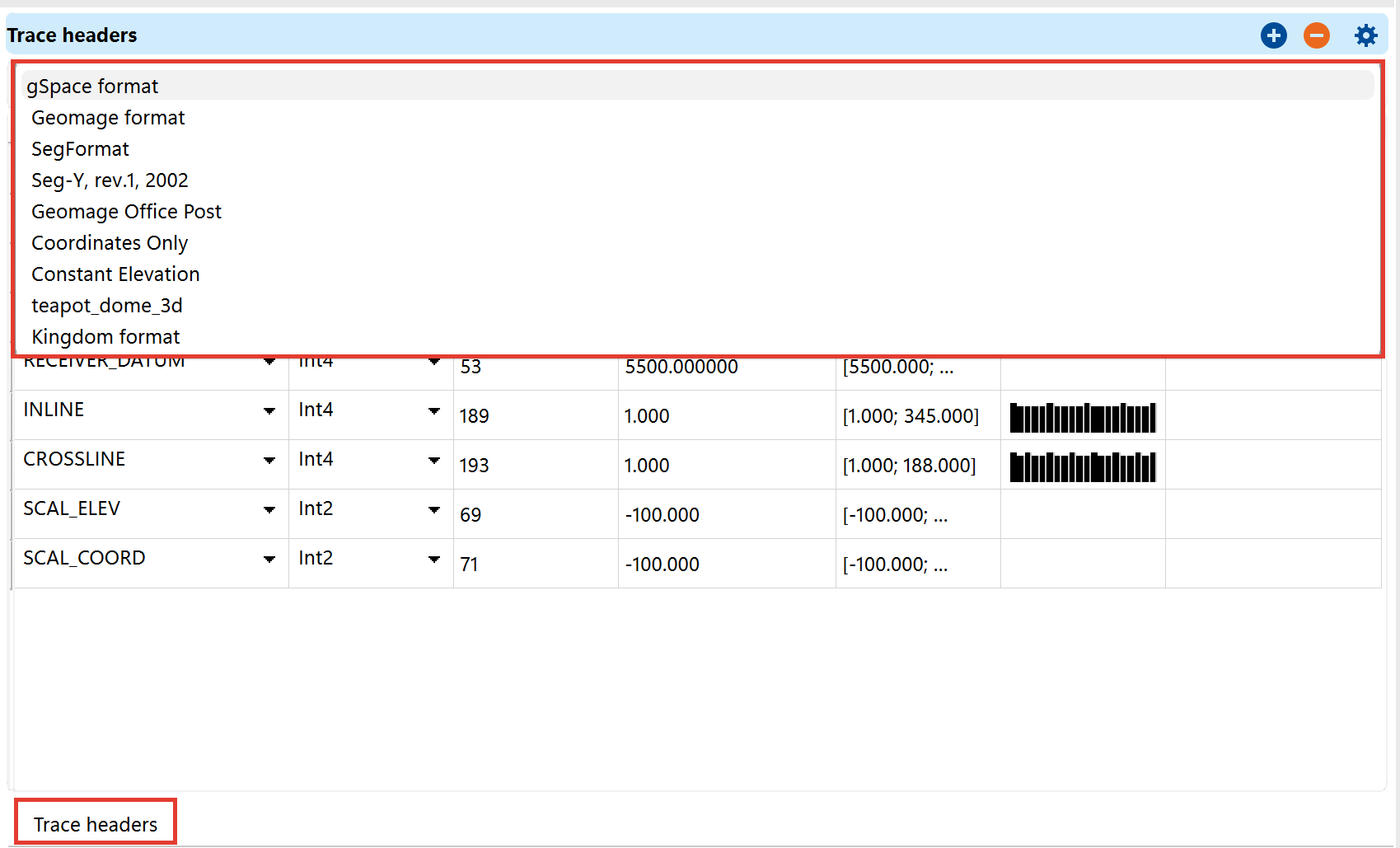
To accommodate variations in SEG-Y files, g-Space includes several predefined formats. Each format specifies particular byte positions for critical data fields. The available formats are:
- g-Space format – Default format optimized for g-Space workflows.
- Geomage format – Used for data processed within Geomage software.
- SegFormat – A generic SEG-Y structure used in various industry applications.
- Seg-Y, rev.1, 2002 – Standardized SEG-Y format based on the 2002 revision.
- Geomage Office Post – A format designed for post-processing seismic data.
- Coordinates Only – Contains only coordinate-related information in the trace headers.
- Constant Elevation – Used when elevation values are uniform across the dataset.
- teapot_dome_3d – A predefined format for specific datasets.
- Kingdom format – A format adapted for compatibility with Kingdom seismic interpretation software.
Managing Formats
Users can manage and customize SEG-Y formats in the Module Properties under SEG-Y format settings and Trace Header Format settings. If the required format is not available among the preinstalled options, users can create a new format by specifying the correct byte positions for the necessary trace header information.
Importing Seismic Data
When importing seismic data, g-Space allows customization of geometry handling. Users should ensure that all relevant trace header information is properly configured before loading the data to facilitate seamless interpretation and analysis.
The data should have all geometry in trace headers and such information can be customized during the loading process of Import seismic