This chapter will guide you through the essential steps of using g-Space software.
You’ll find detailed instructions on installation and licensing, as well as how to create, save, and load projects. Whether you're starting a new project or working with an existing one, this section covers all the basics.
In addition, you'll learn how to configure your project settings, including selecting the appropriate measurement systems supported by g-Space.
We also provide an overview of the demo project included with the software, which offers a hands-on opportunity to explore g-Space’s capabilities with preloaded data.
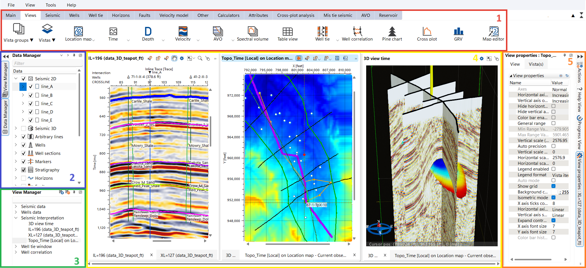
g-Space is a powerful platform designed specifically for seismic interpretation and geomodeling, offering geoscientists advanced tools to analyze and interpret subsurface data with precision.
As the second software package in our product line, g-Space complements g-Platform™ — our leading solution for seismic processing and imaging. While g-Platform™ handles the initial stages of data acquisition and seismic processing, g-Space takes over to drive the workflow from seismic interpretation to comprehensive geological modeling.
In g-Space, seismic interpretation is at the core, with state-of-the-art algorithms and visualization techniques that allow users to accurately identify structural and stratigraphic features, evaluate reservoir quality, and understand properties distribution. The platform excels in integrating seismic data with well logs, stratigraphy, and other geological information, enabling the creation of detailed 3D geological models.
By the end of this chapter, you’ll be equipped with the foundational knowledge to navigate g-Space, configure your projects, and begin leveraging its powerful tools for seismic interpretation and geomodeling, building upon the groundwork laid by g-Platform™.