 | GEOMETRY AND QC |
|
<< Click to Display Table of Contents >> Navigation: Tutorials > Basics >
|
In the g-Platform system there is a few main steps in geometry assignment process:
1.Load traces header information from the input seismic gathers (SEGY, SEGD, ...). For this task we have several options by using different modules: Read SEG-Y traces, Convert SEG-D to SEG-Y, and other.
2.Load source and receiver X, Y coordinates and their relation, in other words it is set of navigation files (SPS, UKOAA/P190) via Load geometry from SPS, Load geometry from UKOOA P1/90, Load geometry from ASCII, Load geometry from SEG-P, Load observer log from ASCII.
3.The next step is merging input seismic traces headers with navigation information. This step is called geometry assignment and g-Platform offers smart interactive tool Geometry application for the current step, as well as geometry quality control.
4.Finally, we should save resulting seismic traces with updated traces headers (with geometry). There is a special modules for saving seismic data into the internal g-Platform data base: Save seismic, Save seismic by gather.
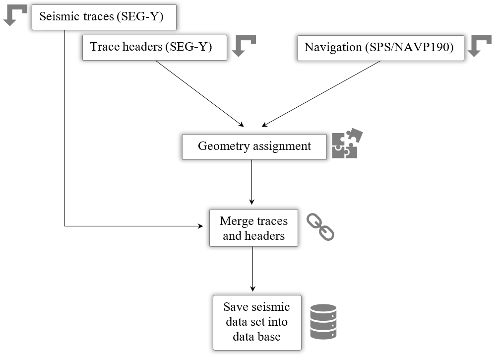
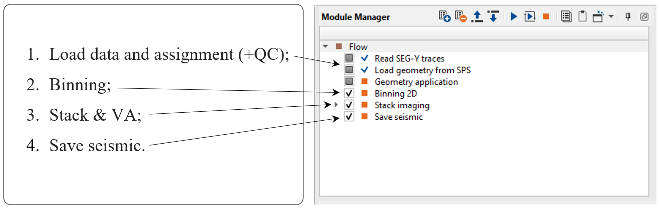
There is a block scheme on the left with the geometry workflow on the right:
 If you have any questions, please send an e-mail to: support@geomage.com
![]() Load Geometry from SPS - Geomage g-Platform - YouTube
Load Geometry from SPS - Geomage g-Platform - YouTube