Export inclinometry
To export well inclinometry press Right Click Mouse on Wells icon in Data Manager and choose Export data and then Inclinometry
Locate file directory, choose file format and click Save
For more information about well headers format please refer to the chapter Well Data Formats
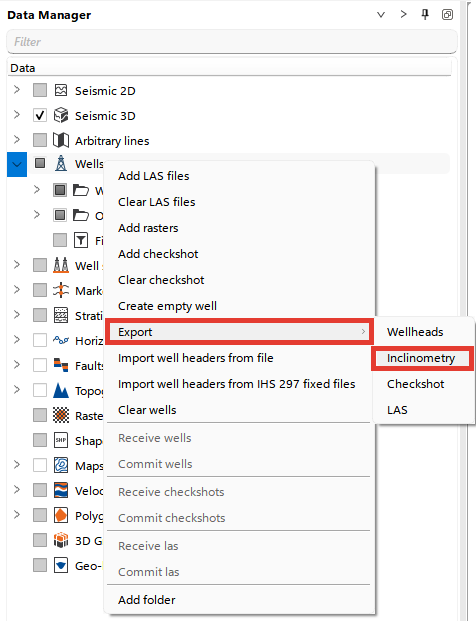
Export well data available from Actions panel as well
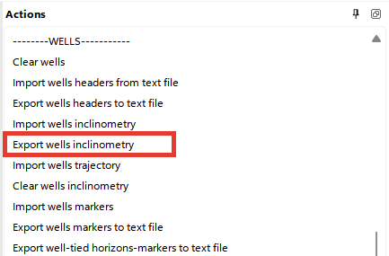
And from the Wells bar from Well inclinometry section

Exported Inclinometry Content
The exported file will contain the following inclinometry data by default:
- Well Name
- UWI
- Measured Depth (MD)
- Inclination (INCL)
- Azimuth (AZIM)
- True Vertical Depth (TVD)
- True Vertical Depth Subsea (TVDSS)
- Easting (X)
- Northing (Y)
- Coordinate Reference System (CRS)
The MD, Inclination and Azimuth values come from the loaded well survey, while TVD, TVDSS, Easting (X) and Northing (Y) are values calculated by g-Space from that survey.
For an Imperial project, the exported MD, TVD and TVDSS values are written in feet. The corresponding column headers are MD (ft), TVD (ft) and TVDSS (ft).
During export g-Space opens a field-selection step where you choose which of these columns to include in the output file before saving.