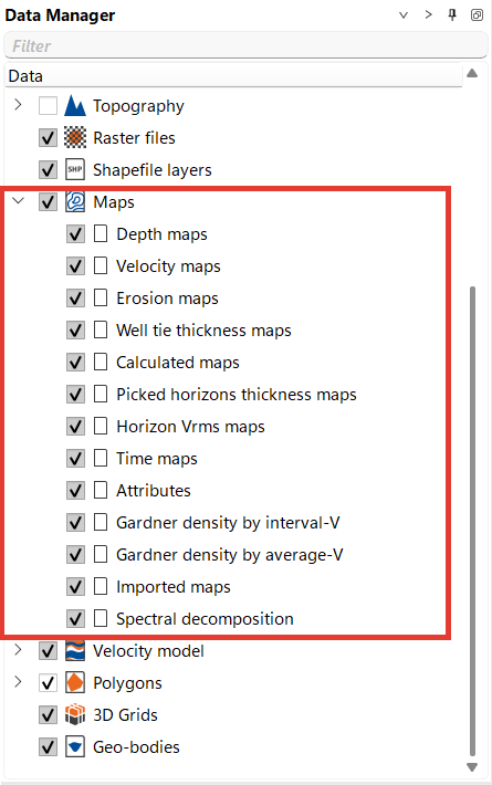
g-Space provides a variety of preinstalled map folders within the Data Manager and allows users to modify settings in Module Properties for customized outputs.
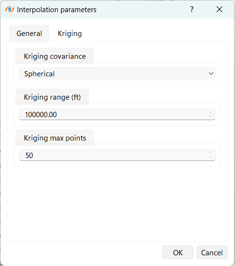
Interpolation settings for creating maps are available in the Calculators Bar by clicking on the Settings icon 
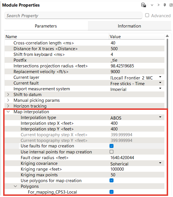
In General tab you can set Interpolation type, Steps, Faults, Polygons for Mapping.

In Kriging tab you can set covariance, range and max points
Advanced interpolation settings are available in the Module Properties.
The g-Space map creation process is highly customizable, with options to adjust settings for different geological scenarios. By using preinstalled map folders, applying appropriate interpolation methods, and incorporating faults and polygons, users can generate detailed and geologically accurate maps.
Mapping in g-Space allows you to generate and edit maps of various geological and geophysical properties. This process includes creating maps from horizons, applying velocity models to generate depth and thickness maps etc., and editing maps through the Map Editor tools.