3D view
3D View is a window that allows users to operate and visualize any geophysical and geological data, such as seismic volumes, well data, polygons, grids, horizons, maps and faults, in a 3D perspective.
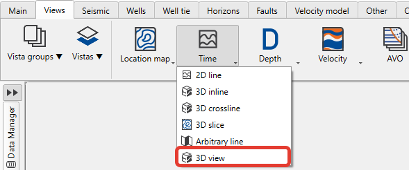
To create seismic section view go to the Views bar on the Ribbon bar and:
to create view in time domain open Time tab and select 3D view:
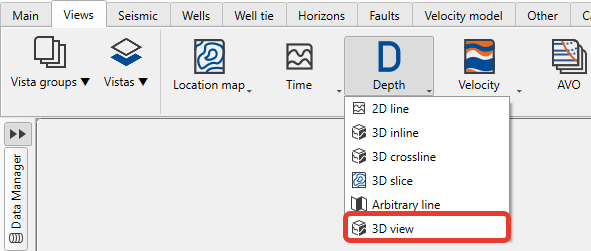
to create view in depth domain open Depth tab and choose between views: 2D line (for 2D data), 3D inline/crossline (for 3D data) or arbitrary line (for both 2D and 3D):
g-Space provides a clear distinction between time and depth domains, organizing Horizons, Faults, and Maps into dedicated folders for each.
For 3D visualization, g-Space offers a feature that allows time-domain data to be displayed within the 3D depth view using the current velocity model. This is especially useful during interpretation, as it enables reviewing results in time without requiring full data conversion to the depth domain.
In order to allow 3D view objects drawing, the user should adjust the Performance section found under Module properties panel.
The main objective of these parameters is to optimize the performance of g-Space by unchecking them when the 3D view is not required. When more features are needed in the 3D view, the corresponding checkboxes should be selected.
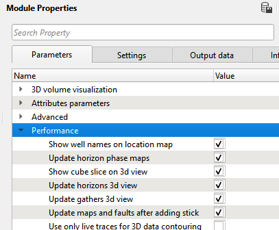
Show well names on location mapDisplays all well names on the location map when checked.
Update volume 3d viewAutomatically refreshes displayed 3D volume content when its visibility is turned on.
Update maps and faults after adding stickAutomatically recreates the grid map of horizons and updates fault sticks when new fault sticks are added.
Use only live traces for 3D data contouringBy default unchecked. When checked, only live traces are used for creating contour maps.
Horizon performance
Update horizon phase mapsAutomatically refreshes horizon phase maps based on changes in horizon data.
Update horizons 3d viewUpdates the 3D horizon view whenever changes are made to existing horizons (e.g., picking, adding new horizons).
Displaying 3D volume
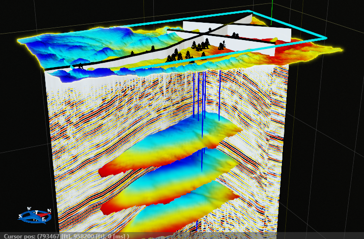
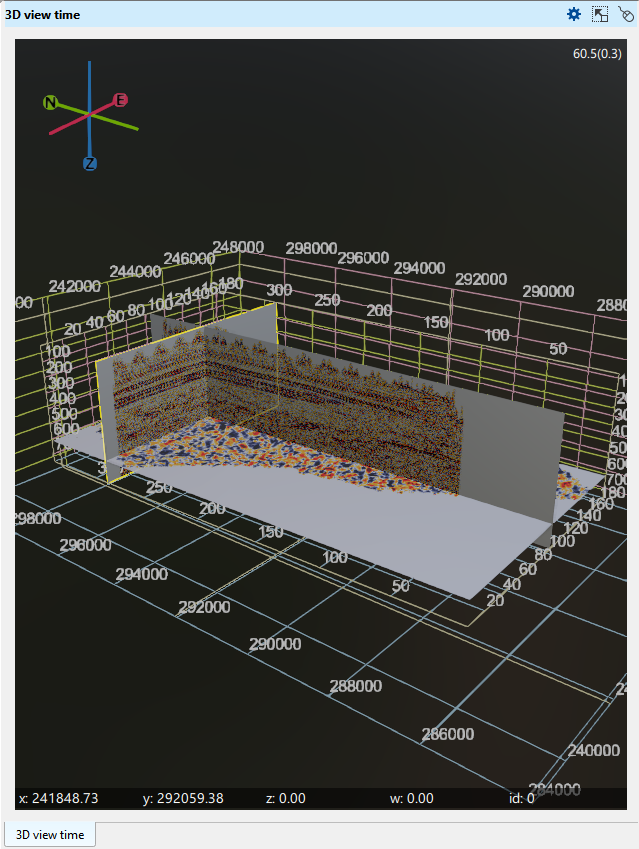
On the picture a few 2D lines, 3D volume, an arbitrary line, time slice, a topography map and wells are displayed on Time 3D view.
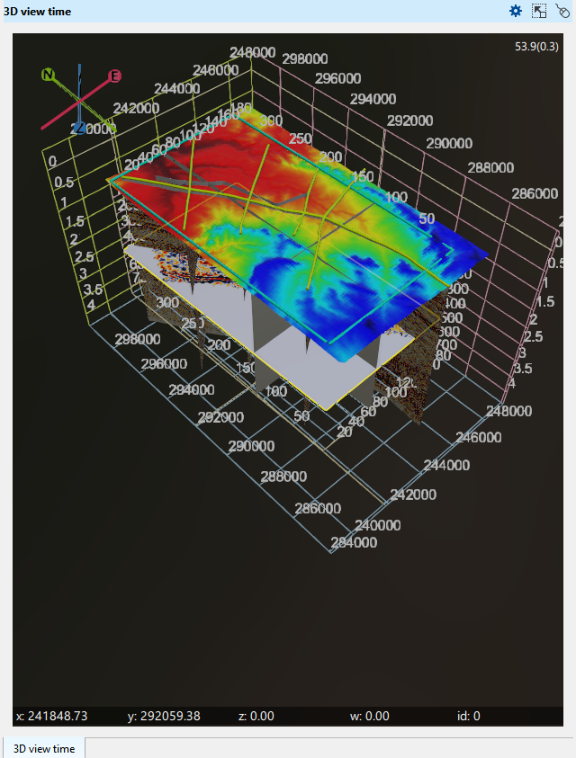
At the bottom of the display, the X, Y, and Z axes are shown, displaying the mouse position and its corresponding values. In the top right corner, the FPS (frames per second) value is displayed.
Horizon display
The view header toolbar has a Horizon display button (horizon icon), which chooses how horizons are drawn in this 3D view. Its menu offers three mutually exclusive modes, and the choice is remembered for each view separately.

FullThe default mode. Horizon surfaces, topographic horizons, maps and horizon attribute surfaces are all drawn.
Projections onlyReplaces the horizon surfaces with projection lines drawn where each horizon crosses the currently visible inline, crossline and arbitrary line sections, coloured from that horizon's own palette. The full horizon surfaces, maps, horizon attribute surfaces and topographic horizons are hidden, while horizon picks stay visible. The lines are rebuilt automatically when the visible sections are moved, added or removed, so the scene stays clean and shows only the interpretation on the sections.
HideHides all horizon objects, including horizon picks.
The mode masks the Visual Settings selection instead of replacing it: an object that is unchecked on the Object(s) tab stays hidden, and the mode only limits what the checked horizon objects may draw. Detailed per-object control therefore remains in Visual Settings.
Vertical scale
In 3D view, two vertical scales exist. One is inside the volume and other is outside the volume. These two vertical scales shows us two different set of values.
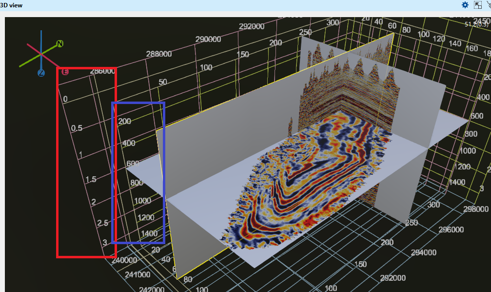
The vertical scale of the inside grid (marked as blue rectangle) is showing the volume in samples. Like if we have 3000ms of record length and we have 4ms of sample interval, it will display like 200, 400 etc.
The vertical scale of the outside gird (marked as red rectangle) is showing the volume in seconds. If the record length is 3000ms then we can see it as 1s, 1.5s etc.
View appearance parameters and object visualization parameters can be set on the Visual Settings panel as for other views.
Anyway a few settings related to 3D view only described below.
View tab:
Background colorSets the colour drawn behind the 3D scene. By default it is black, and the colour belongs to the view, so each 3D view keeps its own choice.
Well scaleThis property changes the thickness (size) of the displayed wells in the 3D view. By default it is 100. When the user changes it into 500 the thickness(size) increase.
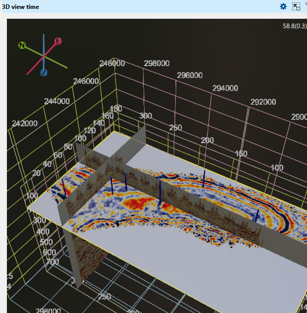
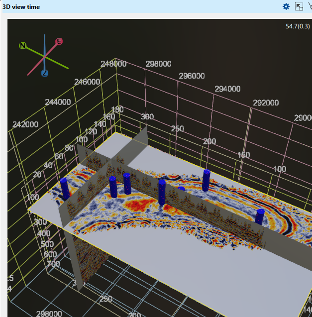
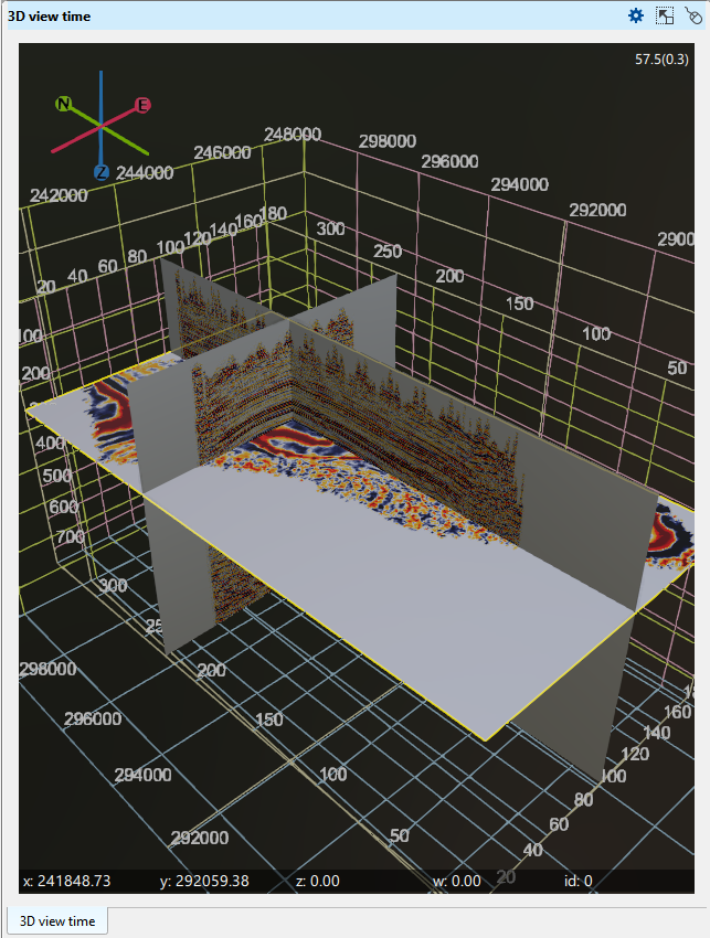
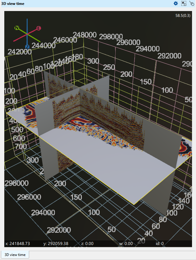
Labels size - The user can change the size of the X, Y, Inline, Crossline, Time/Depth slice labels. By default it is 1. Here we are changing it from 1 to 1.5. We can see the changes in the below image.
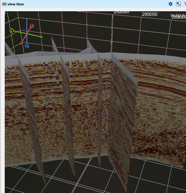
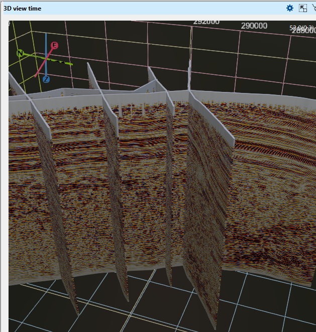
Primitive thickness This parameter increases the display thickness of the 2D, 3D(Inline/crossline/time slice) and arbitrary line. In this instance, we have 1 as by default and changed that into 50 and we can able to see the thickness of the 2D lines as shown below.
Points sizeIt is a scalar for all 3D points like well markers, well rigs etc.
MetalnessThis parameter is similar to brightness/contrast. By default it is 0. If the user changes this to a higher value, say 0.2, the contrast increases as shown below.
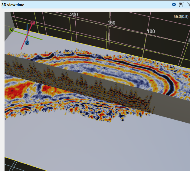
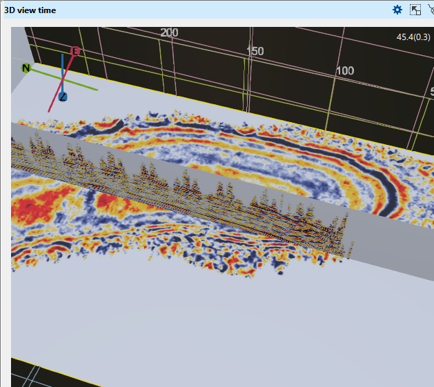
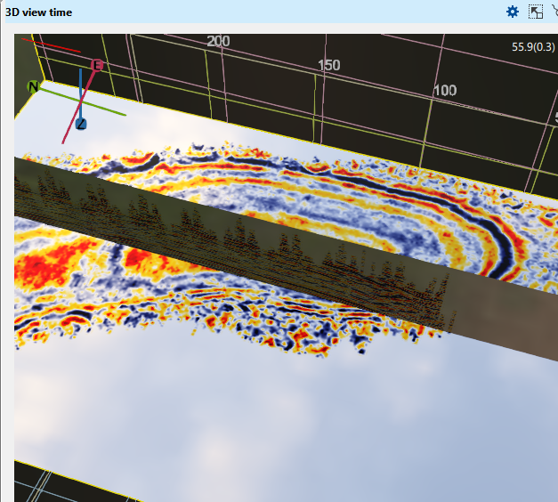
RoughnessThis parameter is also similar to Metalness. The default value is 0.01. It can act like brightness/contrast as shown below.
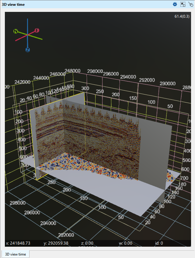
Vertical axis scale adjusts the volume’s size by either expanding or compressing it along the vertical axis. The default value is 2000. In the display, the left side shows the volume with a vertical axis scale of 2000, while the right side shows the same volume with a value of 1000. In the latter case, the vertical scale appears reduced (zoomed out/in), effectively altering the vertical axis’s scalar value.
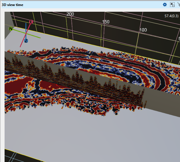
Attribute multiplierThis parameter is like adding gain to the selected display. By default it is 1. When we change it from 1 to 5, it looks like the below shown image.
PerspectiveIt is related to 3D projection. By default it is checked, if it is unchecked the object (in that case like a well marker) the one closer to the focus point is bigger than the one far way from the focus point.
Show global gridShows the coordinate box drawn around the whole scene. By default it is checked.
Show local gridsShows the grids drawn with individual objects, such as the box around the seismic volume and the grids of the well log tracks. By default it is checked. Unchecking both Show global grid and Show local grids hides all the grids in the view, and they stay hidden until you check them again.
Show grid labelsShows the value labels along the grid axes. By default it is checked.
Show handler labelsShows the labels of the objects and their handlers in the scene. By default it is checked.
Horizon display modeRepeats the mode chosen with the Horizon display button on the view header: 0 for Full, 1 for Projections only and 2 for Hide.
AOAO stands for Ambient Occulusion.
BloomAdds a soft glow around the brightest parts of the scene. By default it is checked; clear it to draw the scene without the glow.
Surface value from ZIf the horizons are having attributes (frequency, envelope etc) and the the surface value from Z is turned off, it will take the colorization from the actual attribute value. If the surface value from Z is checked, the colorization will take it from the Z value (time/depth)
IBL enabledIBL stands for Image Based Lighting (IBL). By default, it is checked(TRUE). It is also related to the display parameters. When this is disabled, the display looks very less in brightness.
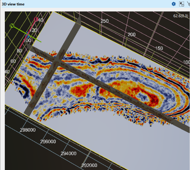
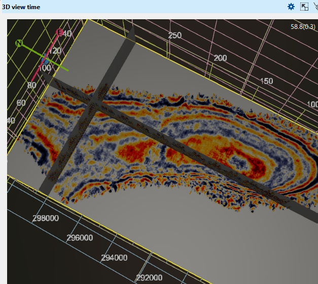
IBL multiplier This parameter is directly associated with the IBL enabled parameter. By default it is 1. If we change it into say 10, it exponentially increases the brightness.
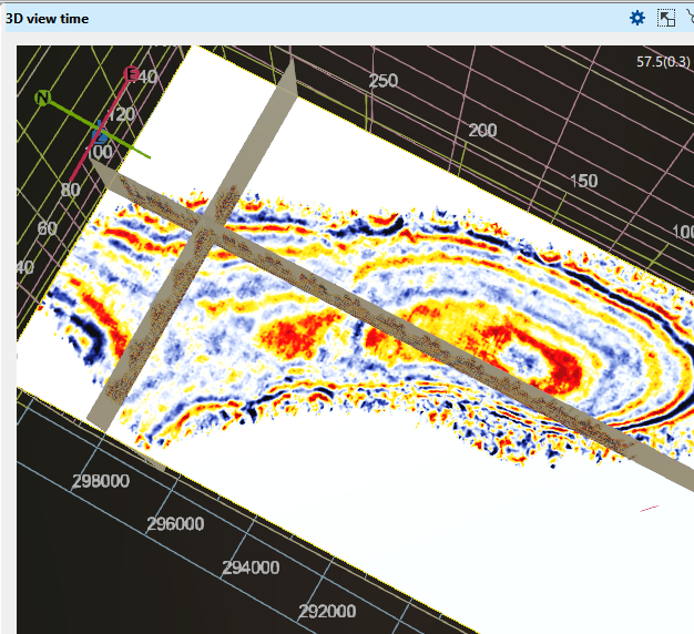
Object(s) tab:
AVO colored binsdisplaying the calculated AVO parameters and selected on AVO crossplot
Loaded gathersdisplaying all the loaded 2D lines in the 3D view time window
3D volume timedisplaying all the loaded 3D volumes
3D Cube attribute timedisplaying any available attributes like frequency, envelope, coherency
Surface seismic 2D geometrydisplaying the loaded 2D seismic lines geometry i.e. the line boundary
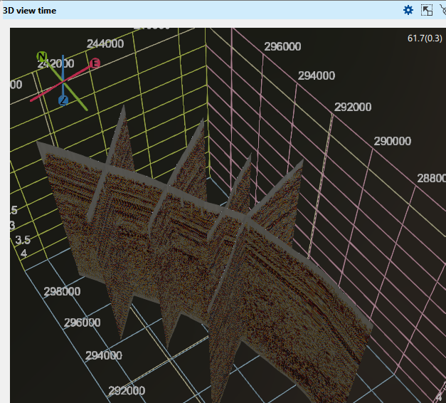
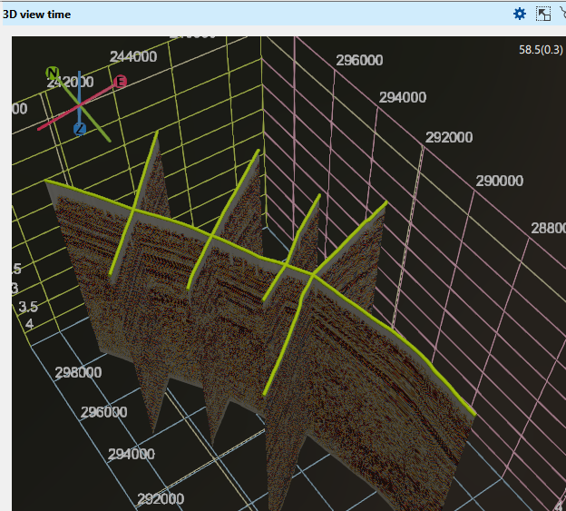
Surface seismic 3D geometryIt will display the loaded 3D volume boundary like all the corner points.
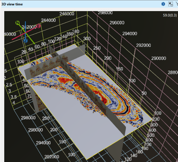
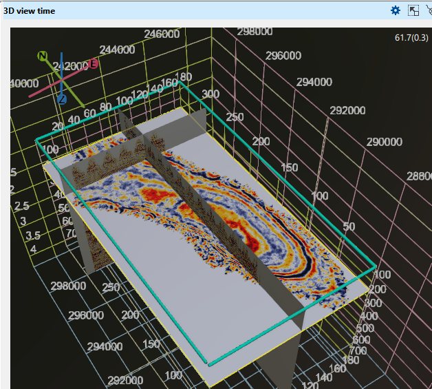
Arbitrary line 3DDisplays the arbitrary lines. All the arbitrary lines of the project are drawn and not only the current one: to show or hide a line, use its check box under Arbitrary lines in the Data Manager, where the current line is the one written in bold. The depth 3D view has the matching Arbitrary line depth 3D item, while its separate Arbitrary line velocity 3D item still shows the current line only.
Horizon 3D TopoDisplays the topographical horizon
Horizon picksDisplays the picked points of the horizons, the same interpretation points that are drawn on the seismic sections. The time 3D view shows the picks of the time horizons and the depth 3D view those of the depth horizons. Unlike on a section, all of them are drawn and not only the current horizon: each horizon is listed under the Horizon picks Object item by its Data Manager name, so to display specific horizons only, expand the item and check or uncheck them. The points are coloured with a palette by the seismic amplitude stored with each pick.
Time maps 3DDraws the maps stored in the Maps --> Time maps folder of the Data Manager as surfaces in the time 3D view, so that maps and not only horizon surfaces can be visualized in 3D. Each map is listed under the Time maps 3D Object item by its Data Manager name, so to display specific maps only, expand the item and check or uncheck them, or use the check boxes of the same maps in the Data Manager.
Depth maps 3DThe same for the depth 3D view: draws the maps stored in the Maps --> Depth maps folder of the Data Manager as surfaces, listed under the Depth maps 3D Object item by their Data Manager names.
Isolines and labels on horizon and map surfaces
Horizons and maps are drawn as surfaces, and every surface Object item offers the same properties for contour lines and for the surface name: Horizon 3D, Horizon 3D Topo, Time maps 3D and Depth maps 3D, and, in the time 3D view, Horizon 3D Attributes and Spectral decomposition maps 3D.
Show isolinesDraws contour lines on the surface. By default it is cleared. The colour, width and step below apply while it is selected.
Isolines colorThe colour of the lines. By default it is black.
Isolines widthThe thickness of the lines. By default it is 1.
Isolines stepThe interval between the lines. By default it is 0.1. Unlike the Isolines step of a map on the Location map, it is not given in the units of the mapped values: it is a fraction of the value range that colours the surface, so it is set between 0 and 1 in steps of 0.01. The default of 0.1 therefore draws a line at every tenth of that range, and a smaller value draws more lines.
Show labelDraws the name of the surface in the 3D scene. By default it is cleared. The labels of horizons and maps are drawn only while Horizon display is set to Full, the mode in which these surfaces are shown.
Label sizeThe text size of the label. By default it is 24.
Label horizontal positionPlaces the label within the extent of the surface: Left, Center (the default) or Right.
Label vertical positionThe same in the other direction: Top, Center (the default) or Bottom.
Fault picksThis section displays the fault picks. By default, the Object item properties are set to a size of 0.2. Users can adjust this value to view the fault picks in a larger size.
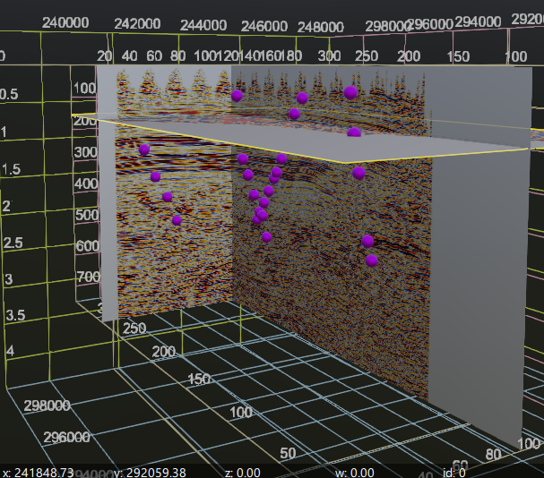
Fault sticks 3DThis feature functions similarly to the Fault Picks Object item but displays the fault points as a line or stick. It connects the fault points into a continuous line. When both Fault Picks and Fault Sticks are enabled, the display will show a combined view, as illustrated in the right image below.
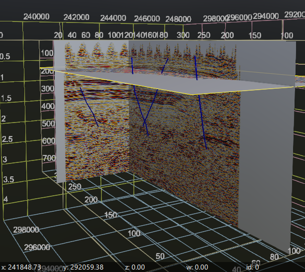
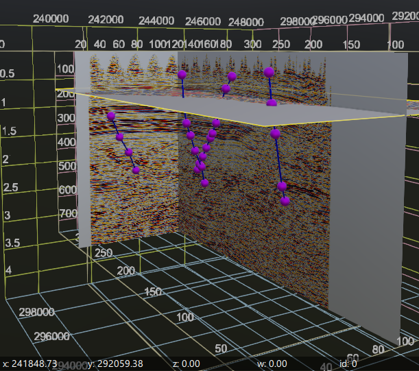
Fault 3DShows a surface that connects all the sticks associated with the same fault, displaying all the picked or loaded faults in 3D view.
Wells 3DAll the loaded wells are displayed here. To manage the visibility of the wells, expand the Wells 3D Object item to check or uncheck them.
Well rig 3DDisplays the well rig.
Markers 3DDisplays all the well markers. The default Size value is 1. To display markers for specific wells only, expand the Markers 3D Object item and check or uncheck individual wells, the same way as in the Data Manager.
Zones 3DDisplays each zone of the marker set as a coloured interval drawn along the well trajectory between the zone's top and base marker; a well that is missing one of the two markers shows no interval. To display specific zones only, expand the Zones 3D Object item and check or uncheck them. They are listed as "<zone name> (TVD thickness)" and stay in step with the matching items under Markers --> marker set --> Zones in the Data Manager. Each interval is also labelled from the zone itself, and two Object item properties control that label. Label content chooses what it shows - TVD thickness (the default), Zone name or Zone name + TVD thickness - so every well's interval is annotated with its own calculated TVD thickness instead of the zone name repeated at each well. The thickness is written with two decimal places and no unit, for example 309.34; Zone name + TVD thickness reads "<zone name>: <value>" and falls back to the zone name alone when no thickness is available, while TVD thickness shows nothing for such a well. Label color sets the colour of the label text, white by default, independently of the zone colour, which still colours the interval. The labels are drawn only while Show label is switched on, which is off by default, and both properties are available for Zones 3D in the time and the depth 3D view.
Observing segmentWhenever the user selects any bin on the location map, the corresponding position is displayed on the 3D view time window.
Polygon 3DDisplays all the loaded polygons.
Polygon selection 3DDisplays the current/selected or default polygon.
Geo-body 3DDisplays the geo-bodies stored in the Geo-bodies folder of the Data Manager. To display specific bodies only, expand the Geo-body 3D Object item and check or uncheck them; each body is listed under it by its Data Manager name.
Grid cell editThe control item of the grid cell editing tool, available in the time and in the depth 3D view. Like Fault picks it is listed on this tab and has its own button on the view header toolbar; switching it on arms the selection of the cells of the S-grids drawn in the view.
Velocity modelA folder with the surfaces of the current velocity model, that is the model set as default in the Data Manager. In the time 3D view it holds Velocity model: interval velocity 3D, Velocity model: average velocity 3D and Velocity model: time skeleton 3D; in the depth 3D view it holds Velocity model: interval velocity 3D, Velocity model: average velocity 3D, Velocity model: interval-depth skeleton 3D and Velocity model: average-depth skeleton 3D. Each item draws one surface per model layer, at the layer's time map in the time view and at its depth map in the depth view; the velocity items colour the surfaces by interval or average velocity, and the skeleton items by the layer's own time or depth value.
To display specific layers only, expand the Object item and check or uncheck them, or use the check boxes of the same maps under the model in the Data Manager: selecting the check box of a group draws all its layers, selecting a single map draws only that layer. The surfaces follow the model that is set as default, so they are rebuilt when you switch the default model or create a new one. Where a map has no values, the surface is left open instead of being drawn across the gap.
Transparency rendering
When several transparent objects overlap, the 3D view can render them with two modes, selectable as Transparency Mode in the 3D scene settings: WBOIT (weighted, blended order-independent transparency) and PPLL (per-pixel linked list). PPLL produces a more physically correct, "honest" result where transparent surfaces cross, at a higher rendering cost. When PPLL is selected, the PPLL Nodes/Pixel value controls how many overlapping transparent layers are resolved per pixel.
Handling the volume if the memory (RAM) is not enough
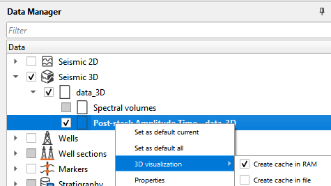
If the user is having enough memory for considerable volume size, they can use the option "Create cache in RAM". To do that, the user should go to Data Manager --> Seismic 3D --> Post-stack Amplitude Time - data_3D (whatever the name the user has given during the loading of the 3D volume) --> Right click --> 3D visualization --> Create cache in RAM. This will use the on board memory to display the 3D volume.
In case the user doesn't have enough memory then they can select the option "Create cache in file". This will take little longer time to create cache file when compared to RAM option (depending on the size of the volume, hard disk type (HDD/SSD)). Once the process is completed, now it will access the file from the hard disk and display the 3D volume. The visualization of the 3D volume speed is as good as accessing from the RAM.
Hot keys
To rotate the volume in any direction use MB3 (Right mouse button). User can also able to do the rotation by holding Ctrl+MB3 button.
To move the volume either up/down or left/right, use Shift+MB3(Right mouse button). This option won't rotate the volume. It will remain in it's original position during the movement of volume quite contrast to using Ctrl+MB3 where it rotates the volume
To move any inline/xline, just click/select on that inline/xline with MB1 and move wherever you want.
To move the time/depth slice, it's as same as the inline/xline. Simply hold MB1 and move up/down.
While the Horizon picks or Fault picks control item is switched on in the view toolbar, MB1 adds a pick point to the current horizon or fault, and Ctrl+MB1 does the same. The picking procedures are described in Horizon picking and Fault picking.
While the Grid cell edit control item is switched on in the view toolbar, the cells of the S-grids drawn in the view are selected with the mouse, and the right-click menu of the view offers Set value, which writes one value into every selected cell. The editing procedure is described in 3D Grids.
MB1A click switches one cell in or out of the selection, and dragging paints more cells in.
Ctrl+MB1Drawn as a rectangle, adds every cell it covers to the selection.
Ctrl+Shift+MB1Drawn as a rectangle, takes every cell it covers out of the selection.
EscClears the selection.
Ctrl+ZUndoes the last Set value step.
The user can use the mouse wheel (MB2 or middle mouse button) to zoom in/out the volume.
To add additional inlines, crosslines click L, to add additional slices for 3D volume click S.