The Map Editor View in g-Space is a powerful tool for creating, editing, and analyzing contour maps and other spatial data visualizations. This view enables users to interactively modify and refine maps that represent various geological or geophysical properties.
To open Map editor view go to the Views bar in the Ribbon bar and click on editor view button:

The newly created view will appear in the View manager in the active Workspase. User can place location map view by dragging it to any workspace except pre-defined once (Seismic data and Well data).
To define the object visibility stile go to the Visual Settings by pressing ![]() in the view functional panel or find it in the panel sets.
in the view functional panel or find it in the panel sets.
Important settings are located in the context menu (alt + RMB):
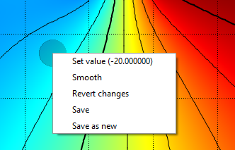
Here the user can:
•set value for the selected function
•smooth entire map
•revert all changes applied
•save edited map instead of original one
•save edited map as new one
Functional panel allows user to perform the following actions:
![]() smooth
smooth
![]() remove pick
remove pick
![]() set value
set value
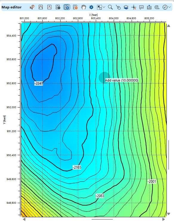
![]() add value
add value
![]() subtract value
subtract value
![]() open Visual Settings panel
open Visual Settings panel
![]() adjust view area to all visible objects
adjust view area to all visible objects
![]() adjust horizontal scale
adjust horizontal scale
![]() adjust vertical scale
adjust vertical scale
![]() set/unset zoomable
set/unset zoomable
![]() set control item
set control item
![]() add Object
add Object
![]() enable mouse tracker
enable mouse tracker
![]() enable tool tip
enable tool tip
![]() export picture
export picture
![]() ruler tool
ruler tool
![]() show compass
show compass
![]() show minimap
show minimap
![]() show scale bar
show scale bar