Actions panel allows to see all available processes that can be executed in g-Space
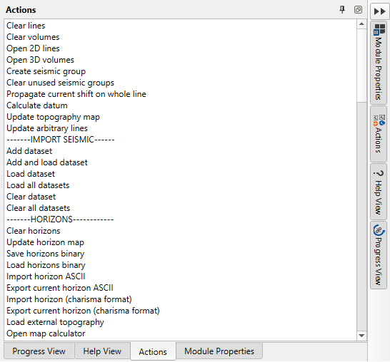
All these actions are mostly duplicated by another button, toolbar or tool, but some of them can still only be found in the Actions panel, especially new features.
Function Name |
Explanation |
SEISMIC DATA |
|
Clear lines |
Removes all loaded 2D seismic lines from the project |
Clear volumes |
Removes all loaded 3D seismic volumes from the project |
Open 2D lines |
Navigate 2D seismic lines for loading into the project |
Open 3D volumes |
Navigate 3D seismic volumes for loading into the project |
Create seismic group |
Creates a new group to organize multiple seismic datasets (for example PSTM, PostSTM etc.) |
Clear unused seismic groups |
Deletes seismic groups that are not currently in use |
Propagate current shift on whole line |
Applies the current time or depth shift across the entire seismic line |
Calculate datum |
Computes the reference level or datum for seismic data |
Update topography map |
Refreshes the topography map with the latest seismic data |
Update arbitrary lines |
Updates user-defined arbitrary seismic lines with the latest data |
Create 3D geological model |
Generates a 3D geological model |
IMPORT SEISMIC |
|
Add dataset |
Adds a new seismic dataset to the project without loading it |
Add and load dataset |
Adds and immediately loads a new seismic dataset to the project |
Load dataset |
Loads a previously added seismic dataset into the project |
Load all datasets |
Loads all available seismic datasets into the project |
Clear dataset |
Removes the selected dataset from the project |
Clear all datasets |
Removes all datasets from the project |
HORIZONS |
|
Clear horizons |
Removes all interpreted horizons from the project |
Update horizon map |
Refreshes the horizon map with the latest interpretations |
Save horizons binary |
Saves the interpreted horizons in a binary format |
Load horizons binary |
Loads horizons from a previously saved binary file |
Import horizon ASCII |
Imports horizon data from an ASCII file |
Export current horizon ASCII |
Exports the currently selected horizon to an ASCII file |
Import horizon (charisma format) |
Imports horizon data in Charisma format |
Export current horizon (charisma format) |
Exports the currently selected horizon to Charisma format |
Load external topography |
Loads an external topography file for use in interpretation |
Open map calculator |
Opens a tool to perform calculations on maps |
Clear calculated maps |
Removes all maps that were generated through calculations from the project |
Import checkpoints ASCII |
Imports checkpoints from an ASCII file |
Export checkpoints ASCII |
Exports checkpoints to an ASCII file |
Create unconformity map |
Generates an unconformities map |
WELLS |
|
Clear wells |
Removes all well data from the project |
Import wells headers from text file |
Imports well headers from a text file |
Export wells headers to text file |
Exports well headers to a text file |
Import wells inclinometry |
Imports well inclination data |
Export wells inclinometry |
Exports well inclination data |
Import wells trajectory |
Imports well trajectory data |
Clear wells inclinometry |
Removes all well inclination data from the project |
Import wells markers |
Imports well marker data |
Export wells markers to text file |
Exports well markers to a text file |
Export well-tied horizons-markers to text file |
Exports the well markers and horizons for tied wells to a text file |
Clear wells markers |
Removes all well marker data from the project |
Load LAS files |
Loads well log data from LAS files |
Clear LAS files |
Removes all loaded LAS files from the project |
Load check shots |
Loads check shot data for wells |
Clear check shots |
Removes all check shot data from the project |
Export all check shots |
Exports all check shot data to a file |
Export wells comments to text file |
Exports well comments to a text file |
Import wells comments from text file |
Imports well comments from a text file |
Clear all wells comments |
Removes all well comments from the project |
Wavelet analysis |
Performs wavelet analysis on well data |
Well log calculator |
Opens a tool for performing calculations on well logs |
Save synthetic trace to LAS |
Saves synthetic seismic traces to an LAS file |
VELOCITY MODEL |
|
Create depth velocity by well markers and time horizons |
Generates a depth velocity model using well markers and time horizons |
Create GRID depth velocity by well markers and time horizons |
Creates a gridded depth velocity model using well markers and time horizons |
Create depth velocity from checkshot |
Generates a depth velocity model using check shot data |
Create depth velocity from VRMS |
Creates a depth velocity model using RMS velocity data |
Create constant depth velocity |
Generates a depth velocity model with a constant velocity |
Create constant layer depth velocity |
Generates a depth velocity model with constant velocities for different layers |
Import depth velocity model |
Imports a depth velocity model from a file |
Update depth velocity by well the |
Updates the depth velocity model using well data |
Clear all well-tied maps |
Removes all maps that are tied to well data from the project |
Pine creation |
Creates a pine tree - tool for the accuracy estimation of the velocity model |
FAULTS |
|
Clear faults |
Removes all faults from the project |
Save faults binary |
Saves fault data in a binary format |
Load faults binary |
Loads fault data from a binary file |
Import fault (charisma format) |
Imports fault data in Charisma format |
Export current fault (charisma format) |
Exports the currently selected fault to Charisma format |
HORIZON PICKING |
|
Convert map to horizon by crosslines |
Converts a map to horizon data along crosslines |
Convert map to horizon by inlines |
Converts a map to horizon data along inlines |
Track horizon by crosslines |
Tracks a horizon along crosslines |
Track horizon by inlines |
Tracks a horizon along inlines |
Track horizon |
General tool for horizon tracking |
Track horizon by whole 3D volume |
Tracks a horizon across the entire 3D volume |
Run QC for selected horizon picking |
Performs quality control checks on the selected horizon picking |
Update 3D view |
Refreshes the 3D view to reflect the latest data and interpretations |
Load picture files |
Loads image files into the project |
Clear pictures |
Removes all loaded image files from the project |
Load shape files |
Loads shape files into the project |
Clear shape files |
Removes all loaded shape files from the project |
Calculate gross rock volume |
Computes the gross rock volume from the seismic data |
Create geo-body from gross rock volume |
Generates a geological body from the calculated gross rock volume |
Calculate attributes |
Computes various seismic attributes for analysis |
Run spectral decomposition |
Performs spectral decomposition on the seismic data |
Import map from ASCII |
Imports a map from an ASCII file |
Update cross plot |
Refreshes the cross plot with the latest data |
Show object properties |
Displays the properties of the selected object |
Calculate HCIIP |
Computes the Hydrocarbon Initially In Place (HCIIP) |
Import 3D attribute data from ASCII |
Imports 3D attribute data from an ASCII file |
MAP INTERPOLATION |
|
Settings |
Opens the settings for map interpolation |
MIS TIE SEISMIC |
|
Set seismic groups priority |
Sets the priority for different seismic groups |
Run for current Intersection |
Runs mis-tie corrections for the current intersection |
Run for all Intersections |
Runs mis-tie corrections for all intersections |
Clear shifts or rotations |
Removes all applied shifts or rotations from the seismic data |
Import cross points table from ASCII |
Imports a cross points table from an ASCII file |
Export cross points table to ASCII |
Exports the cross points table to an ASCII file |
Auto fit volumes |
Automatically fits the seismic volumes together |
Calculate volumes intersections |
Computes the intersections of seismic volumes |
PRE-STACK |
|
Run AVO |
Runs Amplitude Versus Offset (AVO) analysis on pre-stack data |
Calculate AVO maps |
Generates AVO attribute maps from pre-stack data |
Calculate AVO seismic attributes |
Computes various AVO seismic attributes for analysis |
Clear mute |
Removes all mute information from the pre-stack data |
Load mute |
Loads mute information into the pre-stack data |
Save mute |
Saves mute information for the pre-stack data |
DATABASE |
|
Set connection |
Establishes a connection to the database |
Clear references |
Removes all references to database entries from the project |
Sync settings |
Opens synchronization settings with the database |
Send to DB |
Sends the current project data to the database |
Receive from DB |
Retrieves data from the database into the project |
Delete DB data |
Deletes selected data from the database |