Import WITSML
WITSML (Wellsite Information Transfer Standard Markup Language) is an XML-based industry standard for exchanging well data. g-Space imports WITSML .xml files through a dedicated wizard. This topic covers importing WITSML into a g-Space project.
Purpose
Load well data from WITSML documents into the project's Wells folder. A single WITSML file can carry several kinds of object, and the wizard imports them together:
- Wells and wellbores - the well hierarchy and its bores.
- Well headers - identifying and location information such as API number, country, operator, coordinate reference system, depth datum and surface location.
- Logs and curves - log curves with their mnemonics, units and sample values.
- Deviation / trajectory - trajectory stations with measured depth, TVD, inclination, azimuth and location.
- Formation markers - marker names with depth (MD / TVD) and geological attributes.
Import only - g-Space does not write WITSML. The supported WITSML version is 1.4.1.1.
Launching the import
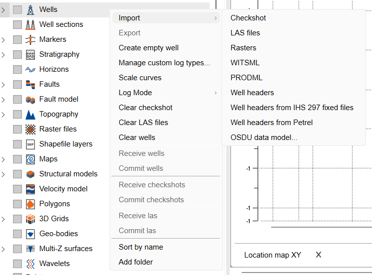
In the project tree, right-click the Wells folder and choose Import > WITSML.
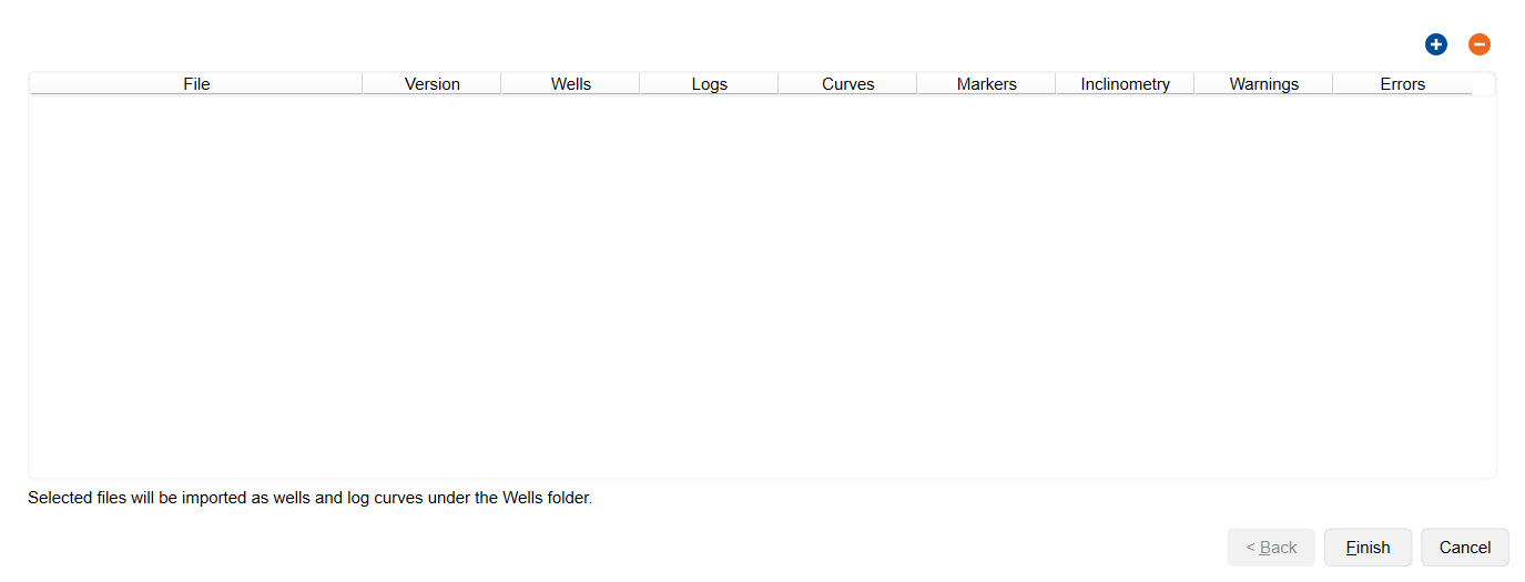
The Import WITSML files wizard opens on a page with an empty file table. The plus and minus buttons above the table (Add WITSML files and Remove selected files) build the list of files to import.
Step-by-step
- Press the plus button and, in the Open WITSML files dialog, select one or more WITSML .xml files.
- Each file is parsed and listed in the table. Review the per-file columns: File, Version, Wells, Logs, Curves, Markers, Inclinometry, Warnings and Errors. Inclinometry counts the trajectories found in the file.
- Use the minus button to drop any file you selected by mistake. Selected files are imported as wells and log curves under the Wells folder.
- Finish the wizard to import. If none of the selected files contain wells, logs, trajectories or markers, g-Space warns before continuing.
- Review the WITSML Import Report that opens after import.
The import report
The WITSML Import Report summarises what was loaded. A header line shows the source, version and totals, and the tree below groups the results into Imported wells, Imported curves, Imported trajectories, Imported formation markers, Warnings and Errors. Use Export to text... to save the report to a file.
When the import finishes, g-Space also shows a short completion message with the totals for the run - the wells created and the curves, trajectory stations and markers added - followed by a list of anything that was skipped. The well total counts only newly created wells; when the import added data to wells that were already in the project, an extra line reports how many existing wells were updated.
Notes
- The importer supports WITSML version 1.4.1.1. Files that declare a different version are reported as an error and are not imported.
- WITSML import is read-only; there is no export back to WITSML.
- g-Space has no separate wellbore object. When a WITSML well contains several wellbores, a separate well is created for each of them and named [Well Name] - [Wellbore Name]; the wellbore name and identifier are kept as metadata on that well.
- Imported objects are matched against the wells already in the project by the WITSML well identifier - combined with the wellbore identifier when the file names a wellbore - and then by the well name or the [Well Name] - [Wellbore Name] form, ignoring letter case. A file that carries only logs, trajectories or markers can therefore be imported after the wells themselves, and a file that repeats a well already in the project updates that well in place: its curves, trajectory stations and markers are added to the existing well instead of a second well being created. Objects whose well still cannot be found are skipped and listed in the message shown at the end of the import.
- Warnings (for example, missing CRS, missing depth datum, curves without units, or stations lacking usable data) do not stop the import - check the report to see which objects were skipped.
See Also