Export shapefile
Esri Shapefile is the standard GIS exchange format. g-Space exports shape layers and polygons to a Shapefile (.shp) so they can be used in GIS and mapping applications.
Purpose
Write polygons or shape layers out as an Esri Shapefile. Multiple polygons are written as features inside a single Polygons layer, so a whole folder can be exported into one shapefile.
Launching the export
In the Data manager, right-click a polygon or the Polygons folder and choose the Shapefile export command, then pick the target .shp file.
A loaded shape layer is exported in the same way: expand Shapefile layers, right-click the layer and choose Export shape file, then pick the target .shp file.
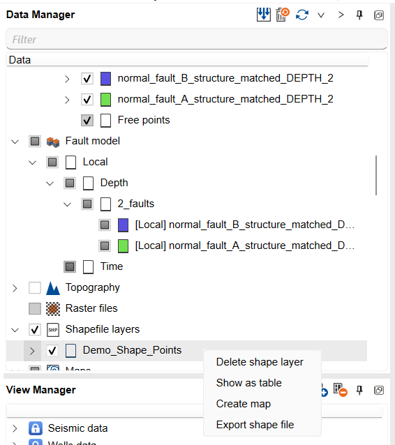
Step-by-step
- Right-click a shape layer under Shapefile layers, or a polygon (or the Polygons folder to export them all), in the Data manager.
- Choose Export shape file for a shape layer, or the export-to-Shapefile command for polygons.
- Select the output .shp file. The companion .shx and .dbf files are written alongside it.
- The file is written in the project coordinate reference system.
Notes
- Only geometry (and basic attributes) are written; g-Space display styling is not part of the shapefile.
- Shapefiles are imported with Import Shapefile.
See Also