Object properties
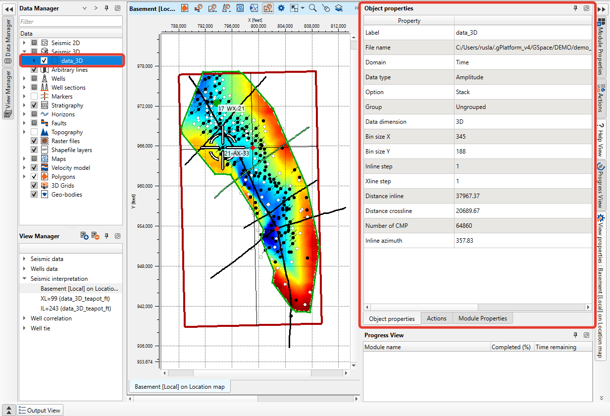
Object properties provides general information about the selected in the Data Manager object
A Copy button in the panel's title bar copies the currently visible table (Properties or History) to the clipboard as tab-separated text.
Other object types (maps, 3D grids, faults, polygons, Multi-Z surfaces, structural models) show their own property sets in the same panel; a <No data> placeholder appears when nothing is selected or the object has no listed properties.
List of properties for seismic data:
Label
File name
Domain
Data type
Option — Stack or Prestack
Group
Data dimension
Bin size X
Bin size Y
Inline step
Xline step
Distance inline
Distance crossline
Number of CMP
Inline azimuth
Bin size X and Bin size Y show spatial distances between neighboring seismic bins in the project's distance units. Bin size Y, Inline step and Xline step are shown only for 3D seismic (2D lines show Bin size X only). Minimum offset and Maximum offset appear for prestack gathers; From azimuth and To azimuth appear for 2D prestack gathers.
List of properties for faults:
Name
User
Created — the date and time the fault was created, as YYYY-MM-DD HH:MM:SS
Source AI volume — the seismic volume used for AI fault detection
Geological type — Unknown, Normal, Reverse, Strike-slip, Strike-slip + Normal offset or Strike-slip + Reverse offset
Sticks — the number of sticks in the fault
This set appears when a fault is selected in the Data Manager. Created shows an em dash when the creation time is unknown, and Source AI volume shows an em dash for faults that were not produced by AI fault detection. The Free sticks section and individual sticks show the <No data> placeholder.
List of properties for maps:
Name
User
Step X — the distance between neighboring map nodes along the X axis, in the project's distance units
Step Y — the distance between neighboring map nodes along the Y axis, in the project's distance units
Number of cells — the total number of nodes in the map grid
Number of cells with values — the number of those nodes that hold a valid value
Minimum value
Maximum value
Delta — the maximum value minus the minimum value
Mean — the average of the valid values
This set appears when a map is selected in the Data Manager. Unlike wells, seismic data and polygons, maps have no Properties command in the Data Manager context menu: the panel is filled as soon as the map is selected. User shows an em dash when the map has no user.
Minimum value, Maximum value, Delta and Mean are given in the map's own units: depth units for depth, erosion, thickness, isochore and isopach maps, velocity units for velocity maps and time units for time maps; maps of other types show their values as stored. These four rows show an em dash when the map holds no valid value, and only Name and User are listed when the map data cannot be read.
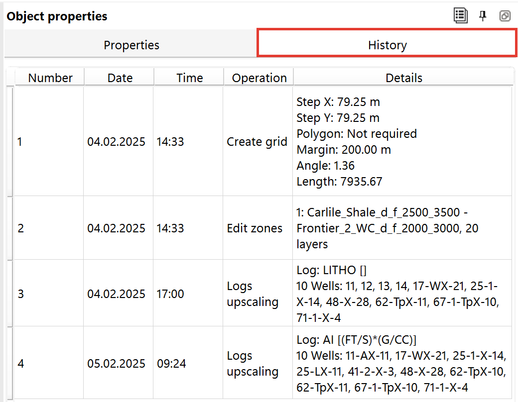
For 3D Grids, the Object Properties panel includes an additional History tab. This tab lists a timestamped history of grid-affecting operations: grid creation (step size, polygon, extrapolation flag, margin, angle, length), zone edits, renames, log/property upscaling, grid-to-grid or seismic-volume upscaling, and building the grid from time inputs.
A grid built with the Time horizons or Time maps input type also gets a Built from time inputs record once its surfaces are calculated. Its Details confirm that the grid is in the time domain and list the horizons or maps the surfaces were built from, so you can check later which time inputs the grid came from.
Each operation is shown as one table row with the columns Number, Date (DD.MM.YYYY), Time (HH:MM), Operation (a short description of the action) and Details (the changed parameters). The Copy button in the panel's title bar copies the whole History table to the clipboard.
Distance values in the Details column are shown in the project's current measurement units, with the unit in square brackets after the value (for example, Step X: 200.00 [meter] in a metric project). Angle is given in degrees and has no unit.