Polygons
Polygons - contains polygons created in g-Space
Right mouse button on the icon allows to:
- Add polygon
- Import > Import polygons from CPS-3 line file
- Import > Import polygons from DXF file
- Import > Import polygons from GOCAD PLine file
- Import > Import polygons from RESQML EPC
- Export > Export polygons to RESQML EPC
- Export > Export all polygons to CPS-3 line file
- Export > Export all polygons to shapefile
- Export > Export all polygons to DXF file
- Export > Export all polygons to GOCAD PLine file
- Clear
- Receive polygons
- Commit polygons
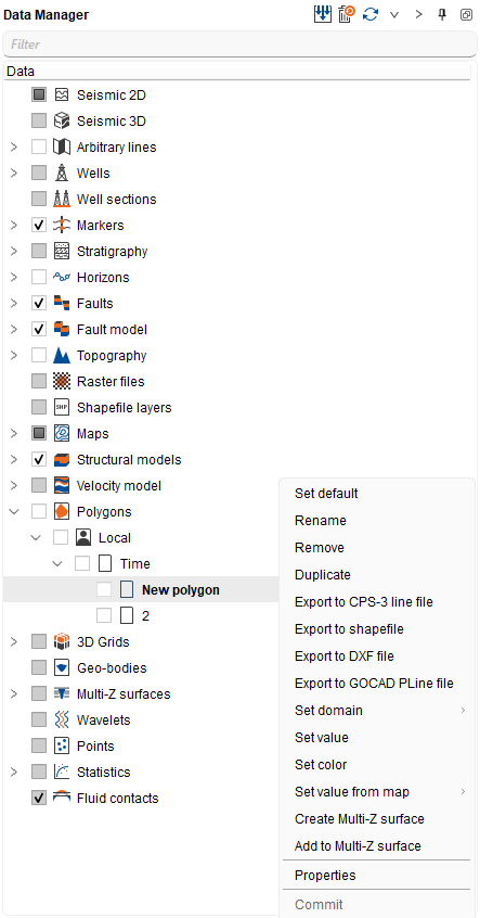
A polygon can be stored either in the Time or in the Depth domain. Right mouse button on a polygon and choose Set domain to switch it between the Time and Depth domains.
Right mouse button on a polygon and choose Set color to give that polygon its own color. The standard color dialog opens; its Reset button clears the custom color and returns the polygon to its default appearance. The color is used in every view where the polygon is drawn, and on the Location map and on the section views it sets the polygon line and point color together. The polygon icon in the Data manager tree is filled with the same color, so the same polygon is easy to recognize both in the tree and in the views.
Polygons are displayed on the Location map, in the 3D view and on the seismic section views: 2D line, inline, crossline and arbitrary line, in both the time and the depth domain.
On a section a polygon is drawn as separate points at the places where its boundary crosses the section line, so a polygon that does not cross the current section is not shown. A polygon stored in one domain is converted with the current velocity model when it is displayed on a section of the other domain.
To show or hide the Polygons object in a section view, or to change its point type, color and size, use the Object tab of the Visual Settings panel.