Export grids
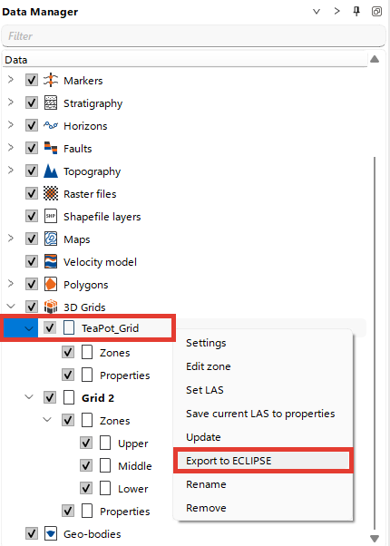
To export Grids stored in g-Space navigate to 3D Grids in Data manager, locate Grid you want to export
Right-click on the Grid, and there is an option to export the grid to Eclipse format
The export process will generate:
- A .dat file containing general grid information and property data.
- A .GRDECL file storing grid coordinates and structure.
The exported file declares its unit system in the header: FIELD when the project uses Imperial units and METRIC otherwise. Grid coordinates and depths are written in the units of the project measurement system, so an exported grid keeps its original position when it is imported back into g-Space.
For more information about maps formats supported by g-Space refer to Grid Data Formats