Trace headers to SPS files
Creating SPS files from the input trace headers
Theory
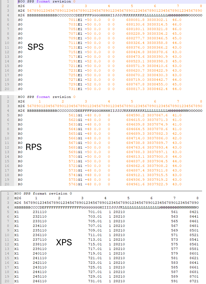
This module creates the SPS format files from the input trace headers. SPS files are standard geometry/navigation files which contains 3 files. One for Source, One for Receiver and one for Relation file.
Source file - Contains Source related information like Line name, FFID, Source X,Y coordinates, Source elevation etc.
Receiver file - Contains Receiver SP, Receiver X,Y coordinates, Receiver elevation etc.
Relation file - Consists of the FFID, Shot point number,first receiver SP, last receiver SP etc.
Input data
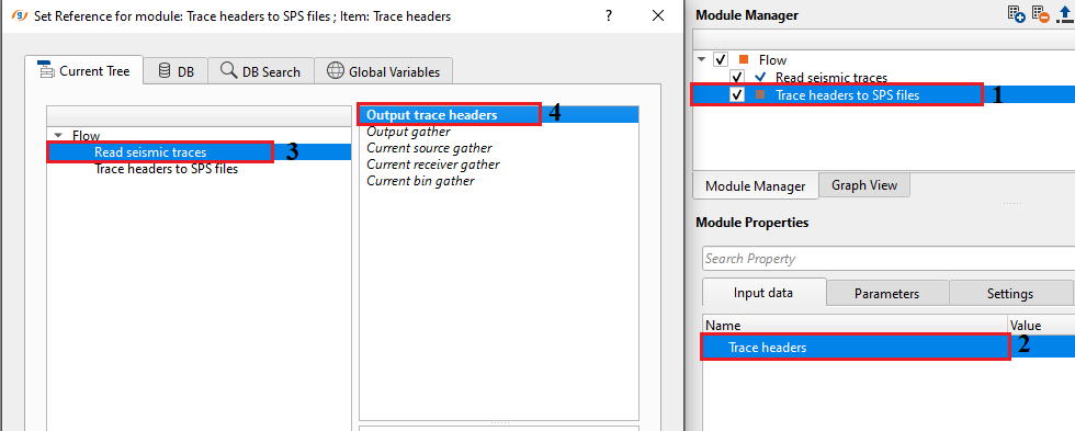
Trace headers
Connect/reference to the input trace headers.
Parameters
Output S-file
Specify the destination path for outputting the Source file
Output R-file
Specify the destination path for outputting the Receiver file
Output X-file
Specify the destination path for outputting the Relation file
Settings
Skip
By default, FALSE(Unchecked). This option helps to bypass the module from the workflow.
Output data
There are no internal outputs from this module. This module directly outputs the SPS file formats.
Information
There is no information available for this module so the user can ignore it.
Examples
In this example workflow, we are reading an onshore internal dataset which got all the geometry information in the trace headers.
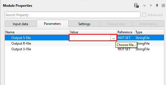
In the parameters, click inside the value tab of the module and click on "...". Provide the path to save the output Source file information. Similarly, follow the same procedure for the remaining two parameters.
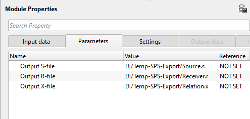
The output files with be added with an automatic extension of ".s, .r & .x" respectively for source, receiver and relation files. The user can QC the output SPS files either by reading them back using "Load geometry from SPS" module or use any text editor to see the SPS format.
Actions
There are no action items available for this module so the user can ignore it.
Video lesson
YouTube video lesson, click here to open [VIDEO IN PROCESS...]
Related articles
Yilmaz. O., 1987, Seismic data processing: Society of Exploration Geophysicist
 * * * If you have any questions, please send an e-mail to: support@geomage.com * * *
